Accurate determination of land boundaries as a key to success
11.02.2025- Problem of Adjacent Land Plots
- Determining Land Boundaries Independently. How Does It Work?
- GPS/GNSS Receivers from "Geometer"
- GNSS Receiver GM SPIKE. Basic Accuracy Level
- GNSS Receiver GM PRO Model S. Best Accuracy Without Paid Signals
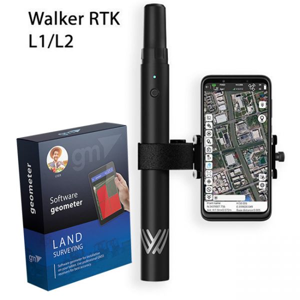
- Walker RTK. Geodetic Precision Positioning
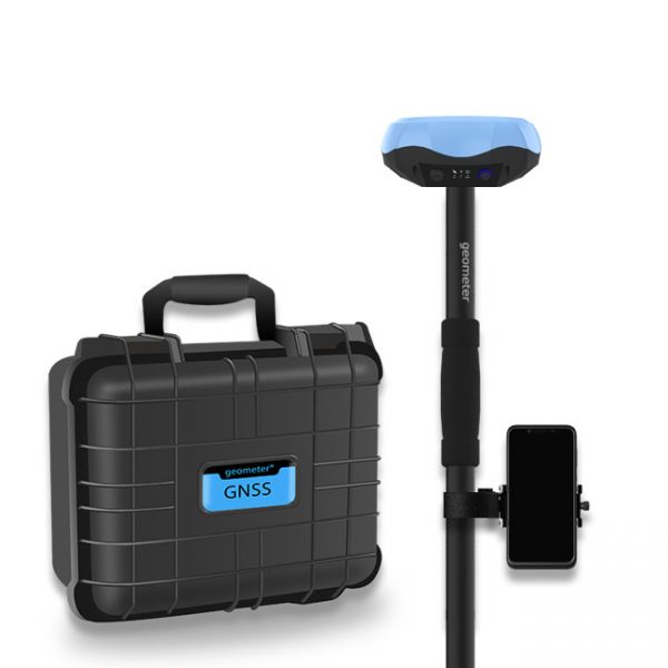
- GNSS Receiver GM PRO Model U. Geodetic Precision Positioning
- Advantages of Using GNSS Receivers for Boundary Determination
Problem of Adjacent Land Plots
In modern agriculture, one of the biggest problems is the lack of clearly defined land plot boundaries. This creates serious issues between neighboring landowners and often leads to conflicts.
In particular, the problem is exacerbated when large fields are divided into shares and distributed among different owners. Often, such distribution results in one or several plots belonging to the same farmer being arranged in a "checkerboard" pattern among other plots. When farmers cultivate their land, they may accidentally enter a neighbor's territory, reducing the area of the neighbor's plot and potentially causing disputes.
The company "Geometer" offers a comprehensive solution: software and GPS/GNSS kits for accurate land boundary determination. Since 2010, the company has been developing and selling industry-specific solutions. Thanks to its accumulated experience and well-established local production, our GPS/GNSS receivers are distinguished by high quality and the best prices on the market. These receivers are in demand not only in Ukraine but also in many other countries.
Determining Land Boundaries Independently. How Does It Work?
-
Using a cadastral number, the coordinates of the land plot points are extracted, and files in KML and TXT formats are generated.
-
The obtained KML or TXT files are uploaded into the geometer SCOUT software, where the user can see their plot on a Google Maps interface.
-
By selecting the "Navigate to Point" function, the program guides the user to the selected point with an accuracy of up to 1 cm. The accuracy of determination depends on the chosen GPS/GNSS receiver.
GPS/GNSS Receivers from "Geometer"
The company "Geometer" offers proprietary receivers that enable precise data acquisition for land plot positioning.
GNSS Receiver GM SPIKE. Basic Accuracy Level
Handheld receiver with a built-in battery. Operates for approximately 20 hours on a single charge. Accuracy: around 1 meter.
-
GM SPIKE kit with geometer SCOUT software: view
-
GM SPIKE kit with geometer SCOUT software and phone: view
GNSS Receiver GM PRO Model S. Best Accuracy Without Paid Signals
Portable receiver with a built-in battery. Operates for about 15 hours on a single charge. Accuracy: 0.2 - 0.4 m. Requires additional accessories for use (pole, phone holder, vehicle roof magnet). It can also operate in RTK mode from a Base Station located up to 5 km away.
-
GM PRO S receiver with geometer SCOUT software: view
-
Full GM PRO S kit with accessories and phone: view
Walker RTK. Geodetic Precision Positioning
Handheld receiver with a built-in battery. Operates for about 15 hours on a single charge. Comes with a phone holder. Accuracy: 1 cm with RTK corrections. Requires a telescopic pole for high-precision field measurements.
-
Walker RTK receiver with geometer SCOUT software: view
-
GNSS corrections available for different time periods:
-
1 day: 350 UAH
-
7 days: 1350 UAH
- 1 month: 3000 UAH
-
All rates: view
-
GNSS Receiver GM PRO Model U. Geodetic Precision Positioning
Portable receiver with a built-in battery. Operates for about 15 hours on a single charge. Accuracy: 1 cm with RTK corrections. Requires additional accessories for use (pole, phone holder, vehicle roof magnet).
-
GM PRO U receiver with geometer SCOUT software: view
-
Full GM PRO U kit with accessories and phone: view
-
GNSS corrections available for different time periods:
-
1 day: 350 UAH
-
7 days: 1350 UAH
- 1 month: 3000 UAH
-
All rates: view
-
Advantages of Using GNSS Receivers for Boundary Determination
-
Avoiding Conflicts with Neighbors. Accurate boundary determination helps prevent accidental land encroachment.
-
Ease of Use. Software enables quick and easy identification of plots and points.
-
Mobility and Autonomy. Devices are compact and operate autonomously for extended periods.
-
High Accuracy. From 1 meter to 1 cm (depending on the model and use of RTK corrections).
-
Time and Resource Savings. Farmers can determine plot boundaries independently without hiring external specialists.
The problem of unclear land boundaries is a significant threat to farmers, as it leads to conflicts and yield loss. Thanks to the solutions offered by "Geometer," farmers can accurately determine the borders of their plots and work without the risk of infringing on others' land. GPS/GNSS technologies not only improve land surveying accuracy but also contribute to the development of modern agriculture.
Using modern technologies in agriculture is the key to success, improved work efficiency, and maintaining good relationships with neighbors!
The complete Walker RTK equipment set with the Geometer SCOUT mobile app for Android is the perfect solution for point collection during infrastructure digitization in the WGS84 geographic coordinate system. It is also ideal for 3D surveying of inspection manholes, sidewalks, curbs, steps, landscape elements, as well as mapping trenches and underground utilities such as electrical, gas, water, and sewage networks.
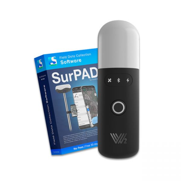
The Walker 2 receiver is an exceptionally lightweight and compact GNSS RTK device, weighing only 220 grams, designed for convenient use in any field conditions. Its sealed and shock-resistant housing withstands drops from heights up to 1.6 meters, ensuring reliability on construction sites, in agriculture, and in challenging terrain.
Special kit for positioning with centimeter RTK accuracy and obtaining high-precision coordinates. The set consists of a dual-frequency GNSS receiver GM PRO model U, rugged smartphone with geodetic software installed.


