
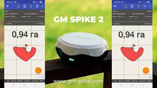
GNSS Kit GM SPIKE 2 for Area Measurement

GNSS Kit GM SPIKE 2 for Area Measurement
- Online Payment
- Payment by Invoice
- Bank Transfer
- Air Mail Delivery
- Delivery via DPD
- Delivery via DHL
A complete equipment set for accurate measurement of agricultural fields.
The GNSS GM SPIKE 2 kit opens up new opportunities for agronomists in field area measurement. The kit includes a rugged Android device that allows agronomists, managers, and accountants to work faster, more accurately, and more efficiently without unnecessary complexity.
The rugged smartphone meets the IP68 industrial standard and MIL-STD-810G military standard. The device is fully sealed and designed for field use. The metal корпус is covered with a shock-resistant rubber layer that effectively absorbs impacts when dropped. The display is protected by Gorilla Glass 3 with enhanced resistance to damage. A convenient mounting option is provided for attaching the GM SPIKE 2 receiver to a vehicle roof using a compact and reliable magnetic mount.
Package includes:
- GNSS receiver GM Spike 2 with built-in battery;
- geometer SCOUT software (pre-installed);
- Rugged smartphone, RAM: 8 GB, internal storage: 128 GB;
- Magnetic mount for the receiver;
- Phone holder for surveying pole;
- Telescopic pole TS180;
- Carrying and storage bag for the receiver.
Advantages:
- Affordable price
- Easy to use
- Complete kit
- Extremely rugged smartphone
- Wide range of features
- Proprietary software
Functional capabilities:
- Measurement of small plots
- Georeferencing points
- Field map creation
- Instant display on Google Maps
- Pass counting when working with wide machinery
- Connection of additional devices via Bluetooth
- Soil compaction measurement (penetrometer support)
- Field division
- Area exclusion (cutting zones)
- Field marking
- Area calculation
- Distance measurement
- Synchronization with Agroprofile
Area measurement accuracy:
Point navigation accuracy:
Resolving field area disputes
With the geometer SCOUT application and the GM SPIKE 2 GNSS receiver, you can easily avoid any disputes. Situations often arise when machinery is hired based on the declared work area. The client may claim their field is 12 hectares, but based on fuel consumption and other resources, you suspect otherwise. In such cases, our GNSS kit provides a reliable solution. Simply walk or drive around the field perimeter, and you will immediately see the field layout and its exact area. Using the Agroprofile portal, you can also print a detailed field report. For higher precision, an RTK receiver kit may be required.
Data security and teamwork convenience
The geometer SCOUT agricultural mobile application installed on an Android device is a personalized solution. Log into your Agroprofile account and synchronize your fields. Share notes and data with colleagues within your organization. Data exchange is secured via encrypted protocols, ensuring that only you have access to your data. Your Agroprofile account is password protected. You can also secure your Android device using a PIN code, facial recognition, or pattern lock.
Working with a penetrometer
The geometer SCOUT app can connect to additional devices via Bluetooth/BLE and receive data from them. When working with a digital penetrometer, soil density parameters are added to measurement points. Results are displayed as graphs on the device and stored for reporting. Upon synchronization, the data is uploaded to the Agroprofile online platform for full history tracking and advanced reporting.
Data transfer to PC and cloud technologies
The Agroprofile online platform is designed to integrate seamlessly with Android devices and the geometer SCOUT application. It enables real-time data synchronization between team members within a company account. Store your field database across all devices and access it securely 24/7. Export measured data in various formats including KML, UTM, MGRS, TXT, CSV, and custom datum formats.
Field division
The geometer SCOUT app features an intuitive interface, allowing fields to be divided into multiple sections using several methods. Need to split a field? Simply tap on the desired location on the screen, and the field will be divided according to your parameters. You have full control over how the field is segmented.
All functions in one click
The geometer SCOUT software is both simple and powerful. Its new logic allows multiple operations and calculations to be performed in a single click. Whether measuring area, splitting fields, or excluding unproductive zones, everything is designed for maximum convenience. Additional features include field marking by passes, optimal route planning, semi-automatic circle creation for irrigation systems, RTK mode support, and real-time display on Google Maps.


-
Dimensions (mm):110x180
-
Weight (kg):0.65 kg
-
Manufacturer country:Ukraine
-
Accuracy:50-70 cm
-
Screen size:5,7 inches (14,48 cm)
-
GNSS receiver type:GM Spike
-
Brand:geometer
-
Number of channels:72
-
Sattelite systems:GPS, Galileo, Glonass, Beidou
-
Frequency:10 Hz
-
Bluetooth:4.2
-
Cold start:29 sec
-
Warm start:5 sec
-
Hot start:1 sec
-
RAM:8 Gb
-
Integrated memory:128 Gb
-
Power supply :Battery
-
Battery life:up to 8 hours
-
Tilt Compensation IMU:No
-
Warranty:1 year
-
Laser:No

Geometer Power Station is a lithium-ion battery in an aluminum body with a capacity of 3400 mAh. This is a useful accessory for GNSS receivers and GeoMeter devices, which will allow you to get extra charge in the field.

Agricultural guidance system geotrack Lite RTK L1/L2 is based on Samsung's 8.7-inch display with LTE, geotrack software and dual-frequency GM SMART receiver L1/L2. This is a low-cost agricultural guidance system with RTK that works with an accuracy of up to 2.5 cm. To get centimeter accuracy, you need RTK corrections or your own base station.