What is Land Surveying and Why is It Important to Have Surveying Equipment?
19.07.2024Land surveying is a set of geodetic works aimed at determining and fixing the boundaries of a plot of land on the ground.
Such work can only be performed by qualified geodetic specialists or cadastral engineers who have the necessary certificates, equipment, and experience. They collect and analyze the necessary documents and conduct a geodetic survey of the land plot to legally fix its boundaries. After the procedure is completed, the data is transferred to the state land relations department for the landowner to obtain a cadastral passport.
The Critical Importance of Land Surveying for Accurate Property Boundaries
Surveying allows for the precise determination of boundaries, area, and position of a plot relative to a coordinate system. The primary characteristic of a boundary is the coordinates of key points, not the length. These coordinates are determined during surveying work.
Inaccurate boundaries can cause disputes with neighbors, leading to serious conflicts. Unauthorized expansion of a plot, especially at the expense of neighboring land, can also cause disputes. Surveying is necessary for the legal determination of boundaries and area of each plot.
The result of surveying is the establishment and agreement of plot boundaries with their fixing on the ground using special signs.
Main Stages of Surveying
- Determination and fixing of plot boundaries
- Establishment of coordinates of external borders
- Preparation and formalization of a boundary plan
- Calculation of the land plot area
- Division or merging of plots
- Restoration of plot contours
Equipment for Surveying
Land has always been a valuable asset, and accurate accounting requires understanding the process and having precise geodetic equipment. When surveying small plots, it is necessary to have geodetic equipment and surveying software for data processing. Satellite geodetic receivers are used to determine the coordinates of boundary marks.
Among the main equipment are satellite GNSS receivers, electronic total stations, light distance meters, theodolites, photogrammetric devices, and digitizers.
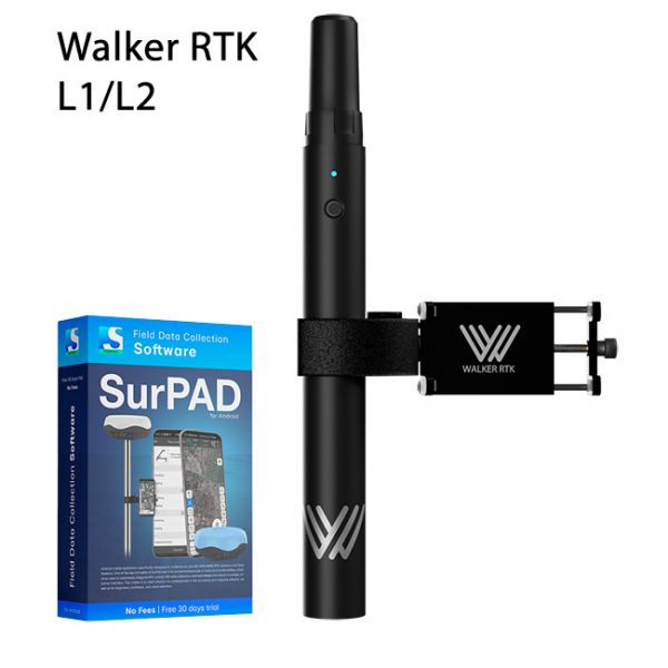
Modern GNSS receivers have become more accessible for ordinary users. One such device is the Walker RTK GNSS kit with the TS180 foldable pole and SurPad 4.2 software. This professional RTK equipment ensures high measurement accuracy. The Geometer company offers flexible rates for RTK corrections, which can be purchased even daily. Data processing may require Digitals software.
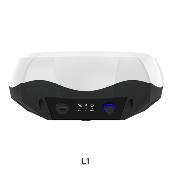
Often, there is a need to remeasure or measure another plot of land after the surveyor has left, and calling him back will again cost money. We recommend the simple-to-use and most compact GNSS RTK kit, GEORA. This "baby" is the most modern or even more accurate than the geodetic GNSS equipment of many surveyors. With RTK corrections, this device can provide an accuracy of 8 mm horizontally and 15 mm vertically. GEORA has a protected and shockproof body design according to IP67 standard, weighs 220 grams, has a tilt compensation sensor, and 15 hours of battery life. GEORA GNSS impresses with its fast initialization time. Using GEORA GNSS, the user will always have the opportunity to check previously measured points and set an unlimited number of new ones. GEORA GNSS also comes with professional geodetic software.
Alternative Options for Own Land Surveying Needs
If high-precision determination of plots is not required, and accuracy up to 0.5 meters is sufficient, consider the GM SMART and GM PRO S receivers. These receivers are similar in technical specifications, but the GM SMART requires external power from a power bank, while the GM PRO S has a built-in dual battery and can work autonomously without extra wires. These receivers show high relative coordinate accuracy. They work accurately in coordinate smoothing mode without paid corrections.
Due to their affordable price and high relative accuracy, incomparable with cheap receivers on UBLOX boards, GM SMART and GM PRO S receivers remain the most popular choices for non-professional users when measuring field areas and determining plot boundaries. For simpler measurement tasks, such as internal plot surveying, field area measurement, small plot measurement, distance measurement, plot division, point location, and soil sampling, the geometer SCOUT software for Android is used. This is simpler software.
The geometer SCOUT software for Android allows for easy measurement without involving professional surveyors. After completing the survey, the user receives an electronic map of the plot, which can be viewed on a computer or printed.
Current Legislation Norms and Requirements
According to the "Land Management" Law, surveying and further documentation must be performed by certified land management engineers who have passed the qualification exam and are registered in the State Register of Certified Land Management Engineers.
Using GNSS receivers GM SMART or GM PRO S for internal surveying work is recommended and allows you to independently determine coordinates and set marks without involving surveyors, significantly reducing work costs.
Walker RTK with professional surveying mobile application SurPAD is the ideal kit for surveying, as well as for 3D surveying manholes, sidewalks, curbs, steps, landscaping, mapping trenches, and underground utilities such as electricity, gas, water, and sewer lines
The single-frequency GNSS receiver "GM PRO S" of improved accuracy on a free satellite signal. A new series of receivers in a compact GM PRO mini body. The receiver has 335 channels for communication with satellites. Works with all satellite systems: GPS, GLONASS, GALILEO, BEIDOU, QZSS and can work in any country in the world. It can be used in geodesy, agriculture, forestry and other industries where high accuracy is important.


