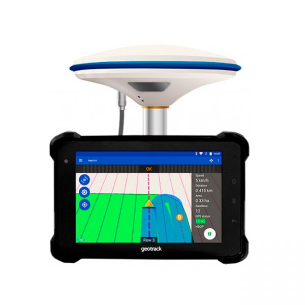
Geotrack – affordable precision farming systems seamlessly connect field work and efficient agribusiness management
07.09.2022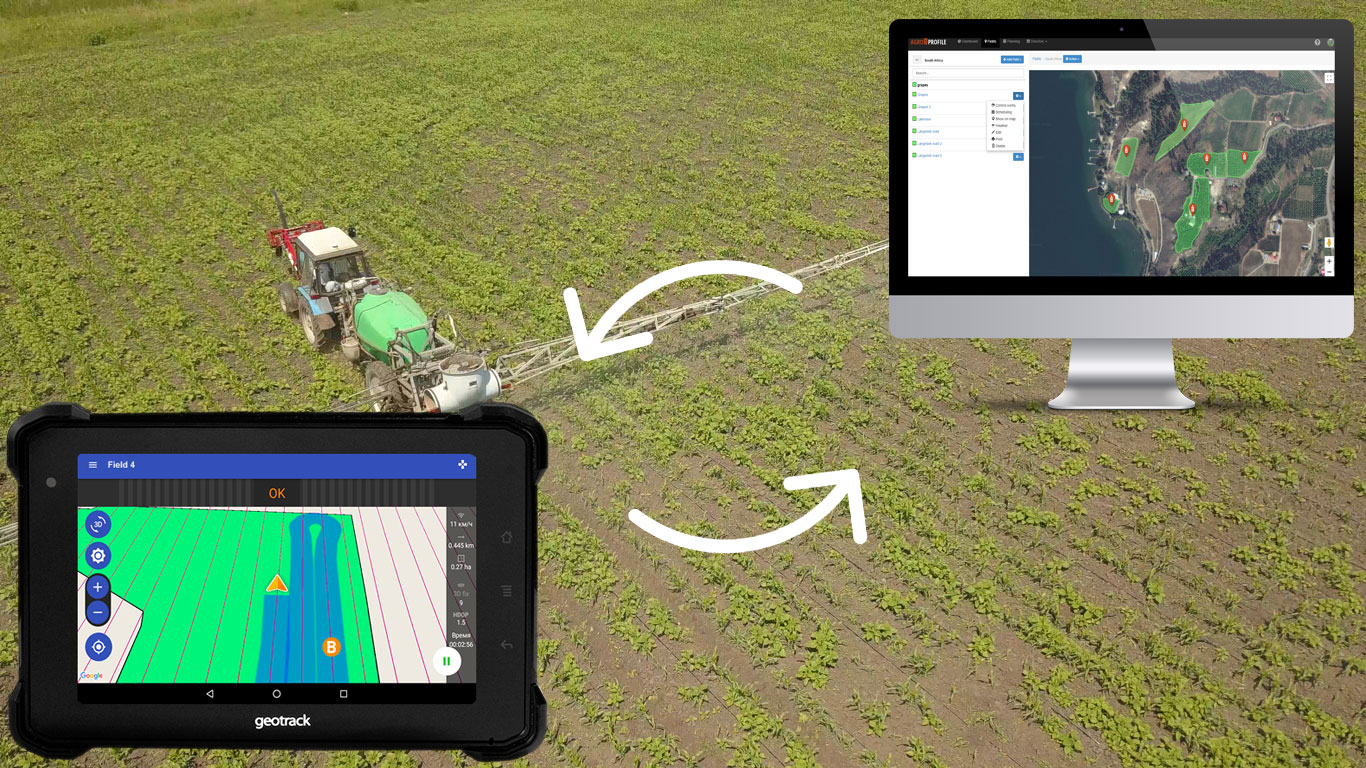
Precision farming is no longer a trend, but a necessity in modern agribusiness. Nowadays, to be competitive, it is not enough just to grow and harvest the crop, but it is necessary to get it with the lowest costs and losses.
The constant growth of prices on seeds, fertilizers, and agrochemicals requires the farmer to use them effectively and control them. Precision farming technologies have been developed to change the rules of the game in the tillage market. Their use makes it possible to reduce the cost of fuel, fertilizers, and herbicides by 10-15% on average. Control over tillage of each square meter of the field significantly increases the efficiency of agricultural machinery use and labor productivity.
It is known that the systems of parallel driving as a part of precision farming technology significantly increase the efficiency of field treatment.
Traditionally in agribusiness, it is so that the performance of fieldwork and its management are two interrelated processes, but in practice do not interact with each other. Farmers use a limited set of functions, for example, only parallel driving and assess only the current situation in the field. Forecasts, work planning, work history, etc. – these works are either not performed or are maintained in a separate system, which significantly reduces the efficiency of agribusiness.
Geotrack parallel driving systems are among the few that seamlessly connect agricultural navigation and Agroprofile’s online farm management platform into one system with real-time, two-way data exchange. This makes them radically different from other agricultural navigation systems and provides the greatest savings for the farmer.
How it works
To perform field work, the tractor operator only needs to enter information about the farming equipment with which he will work the soil on his Geotrack device. The program will automatically calculate the correct trajectory across the field, taking into account the set working width of the trailed unit and the entered deviation sensitivity.
On the other hand, the farmer creates an account in the Agroprofile online analytics platform. The platform communicates in real-time via API with each guidance system working in the field, and each navigator returns information about the current operation to the platform server and displays it on a computer, tablet, or smartphone screen.
The farmer can create his fields (mark them on the map or import them from the guidance system), display them on Google maps, see the weather for each field, plan work and resources, and store the history of completed work by season.
To control the management of personnel and work the farmer can create employee accounts with limited or full access to the data.
Information output is available in the form of various reports for the entire farm or each field separately.
What parallel driving systems are Geotrack
Geotrack Agricultural guidance systems is a carefully selected combination of a GNSS/RTK device and proprietary Geotrack EVO software in API interaction with the Agroprofile online platform.
Due to flexible equipment Geotrack navigation range occupies the niche of affordable professional agricultural navigators in the medium price range and budget systems up to $1000 with professional features.
Geotrack Explorer Plus:
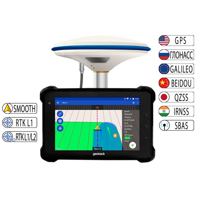
Professional agricultural navigation system for any tractors combines and self-propelled agricultural machinery. They were equipped with a modern GNSS/RTK receiver GM SMART, which simultaneously works with satellite systems GPS, GLONASS, GALILEO, BEIDOU, and QZSS. The farmer will always have enough satellites for uninterrupted work in the field, even in remote rural or mountainous areas with weak signal strength. The average number of satellites in working mode is more than 35.
The Geotrack Explorer Plus has built-in EVOLUTION series software for parallel driving accuracy of 15 cm from pass to pass, and the ability to improve accuracy to 1-3 cm when connected to RTK.
The Geotrack Explorer Plus 7″ display is sealed, shockproof, and protected against dust and moisture.
Geotrack Lite:
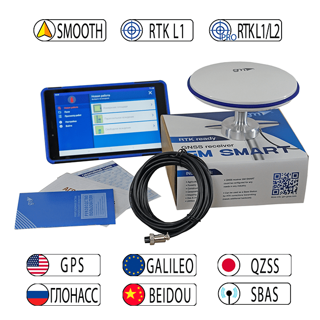
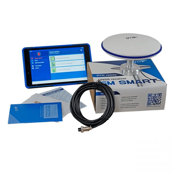
The best parallel driving system in the under $1000 USD price range with professional features. Based on Samsung 8.7″ display, Geotrack EVOLUTION parallel driving software, and GM SMART GNSS receiver.
The GM SMART receiver has a special smoothing filter designed for agricultural use. The smoothing filter ensures high parallel driving accuracy. The receiver has 335 channels for all satellite systems: GPS, GLONASS, GALILEO, BEIDOU, QZSS, and SBAS. Provides accuracy of parallel driving at the level of 15 cm from pass-to-pass.
Company information about the manufacturer of Geotrack systems
Geometer International is an European manufacturer that has been developing high-tech GNSS/RTK devices and software for precision agriculture, surveying, urban and infrastructure digitalization, forestry, construction, and other industries requiring high-accuracy satellite positioning since 2009. GNSS/RTK devices under Geotrack and Geometer brands are used by farmers and engineers in more than 33 countries. Now the company is increasing its expansion into the African agricultural market with its affordable Geotrack-branded multifunctional parallel driving systems.
Technical product support Geotrack
Geometer International provides technical support to farmers who use Geotrack products worldwide. Potential customers can get more information at website. Before contacting a technician via the contact form on the website, WhatsApp, or e-mail, customers can watch the many videos, instructions, and technical documentation on Geotrack instruments that are available on the website.
Agricultural guidance system geotrack explorer PLUS is a new development by Geometer company, which provides 15 cm of accuracy from pass-to-pass, and the ability to connect to RTK and obtain an accuracy of 1-3 cm.
Agricultural guidance system geotrack Lite RTK L1/L2 is based on Samsung's 8.7-inch display with LTE, geotrack software and dual-frequency GM SMART receiver L1/L2. This is a low-cost agricultural guidance system with RTK that works with an accuracy of up to 2.5 cm. To get centimeter accuracy, you need RTK corrections or your own base station.


