
The choice of the coordinate system at the beginning of the project is the basis on which the correctness of further measurements, calculations and works carried out using the SurvX software depends.
The application provides several options for setting and transforming the local coordinate system. Before you start setting up the coordinate system, you should first find out whether the local GNSS network provider supports RTCM correction data for messages from 1021 to 1027, and send requests to the local GNSS service provider for CORS encrypted parameters if it supports them. Also, if you are working in this area for the first time, it is advisable to consult with local specialists to choose the best way to set the local coordinate system, which may differ not only in each country, but also, for example, in each state of the USA.
How to set up local coordinate system in SurvX application
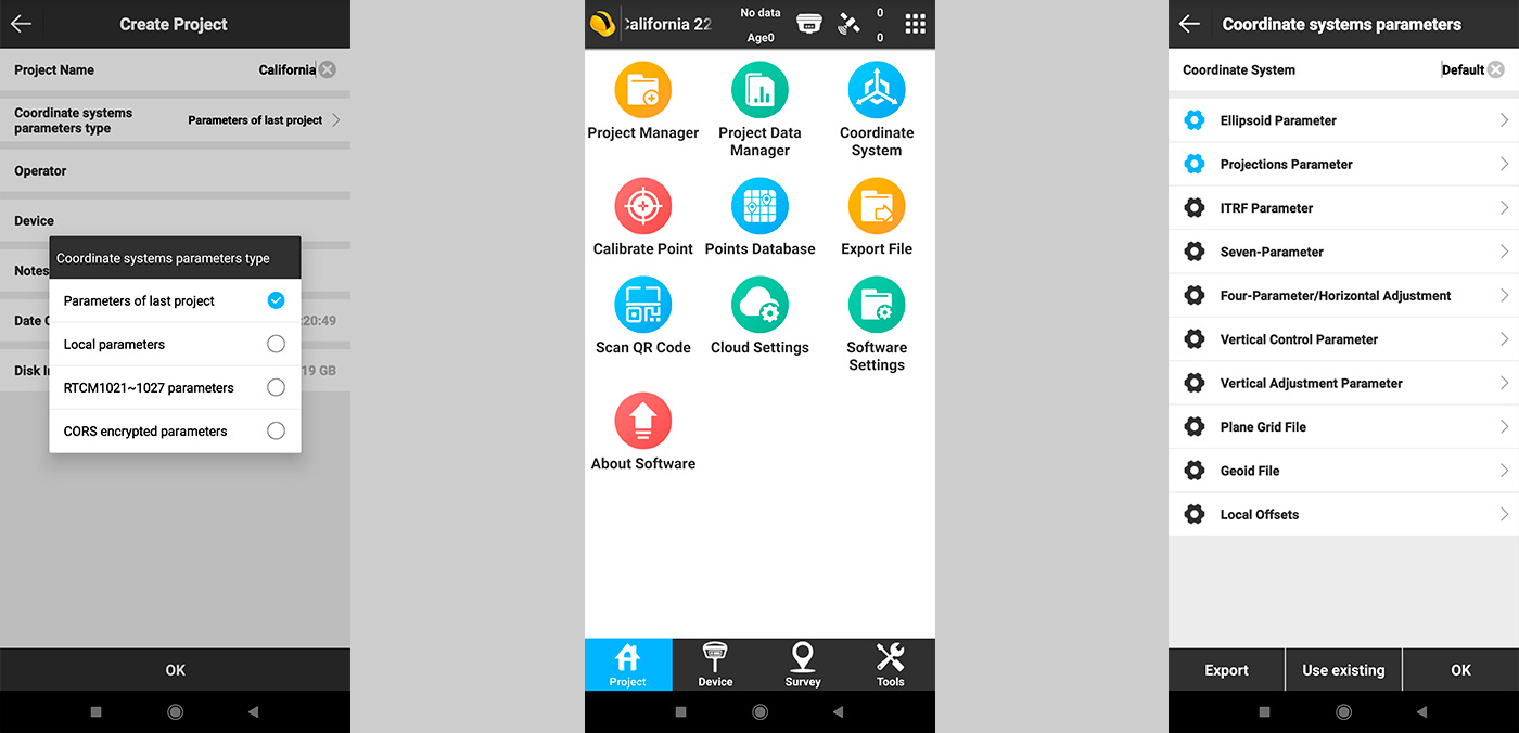
To do this, go to the application on the first Project screen and select Project Manager (Fig. 1).
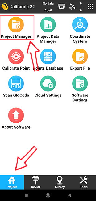
Fig. 1. Main screen of the SurvX application
For a new project, you need to specify a name, for example, California 22. In the item Coordinate systems parameters type there is a choice of several items.
To simplify the selection, the program has the Parameters of last project setting (Fig.2), which allows you to copy the coordinate system parameters from the previous project. This is a convenient setting if you continue to work in the same area where you worked before.
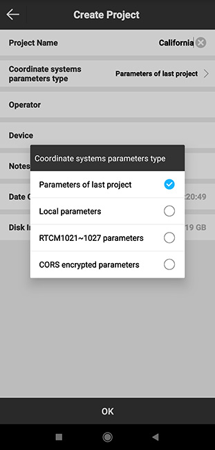
Fig. 2. Copying coordinate system parameters from the previous project in the SurvX application
Local parameters – in this menu item, you can either select the preset parameters of the local coordinate system, or enter new ones manually if you know them (Fig. 3).
Fig. 3. Manual setting of local coordinate system parameters in SurvX application
RTCM 1021 ~ 1027 parameters – RTCM protocol which is able to transmit parameters in its messages to transform coordinate systems in the area where you directly perform measurements. This is the easiest and most convenient way to work in the local coordinate system. In order to use it, you first need to check with the local GNSS network provider whether it supports this type of correction for messages from 1021 to 1027 (Fig. 4).
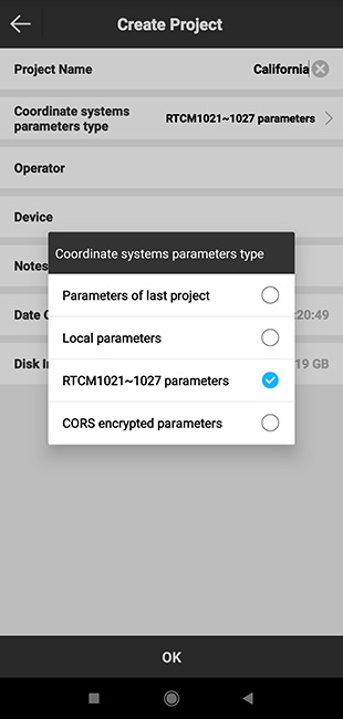
Fig. 4. Setting the parameters of the local coordinate system via RTCM 1021 ~ 1027 in the SurvX application
CORS encrypted parameters – to use this option it is necessary to submit a request to the GNSS network provider for these parameters, if it supports them (Fig. 5).
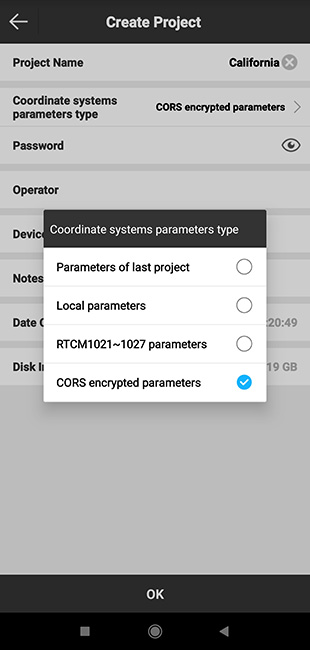
Fig. 5. Setting the parameters of the local coordinate system through CORS encrypted parameters in the SurvX application
Enter the settings manually. To do this, select the Local parameters item, after which the following window automatically opens (Fig. 6).
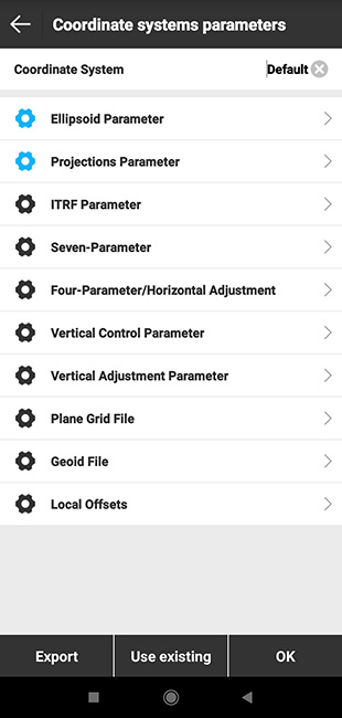
Fig. 6. Setting the parameters of the local coordinate system manually in the SurvX application
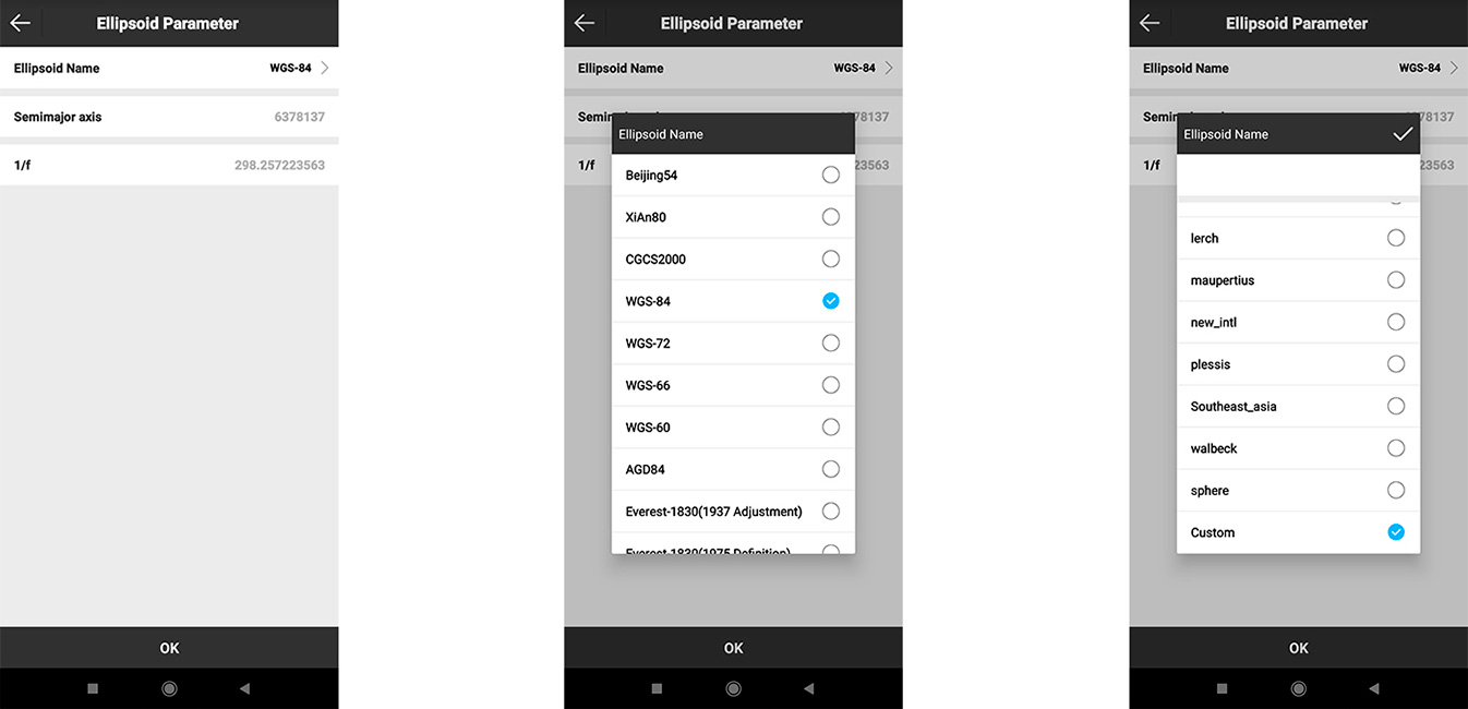
Next, select the Ellipsoid Parameter item (Fig. 7) and enter the coordinate system selection menu. Choose the Ellipsoid name you need from the list (Fig. 8). If the list does not contain the predefined coordinate system that you need, then at the end of the list you will need to select the Custom item (Fig. 9).
 If you already know the transformation settings, you can enter them in the following menu items (Fig. 10).
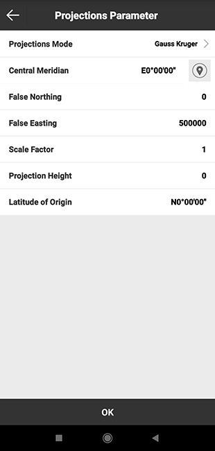
Fig. 10. Setting the parameters of the local coordinate system manually in the SurvX application

SurPAD 4.2 Android software is a low-cost solution that will allow you to carry out professional geodetic services, work with points, measure distances, create electronic maps, stake-out, survey.

The "GM PRO U" GNSS RTK receiver is a dual-frequency (L1, L2) 184-channel RTK receiver that works simultaneously with several satellite systems and receives corrections in RTCM 3.X.X format. This receiver is compatible with any software. A new series of GM PRO mini receivers in a compact case.

GNSS RTK receiver GM PRO L is a multi-frequency (L1, L2, L5) 965-channel receiver with an antenna that operates simultaneously with GPS, GLONASS, GALILEO, BeiDou, QZSS, IRNSS satellite systems and accepts corrections in the RTCM 3.X.X format. This receiver is designed to work with any software. Designed for professional use in surveying, agriculture, forestry and other industries where high accuracy is important.