Using GNSS RTK for deformation monitoring
05.12.2023Deformation monitoring is a vital aspect of ensuring the stability and safety of engineering structures, whether they are bridges, buildings, dams, or road surfaces. The essence of this process lies in observing and analyzing changes in the structure and shape of objects under the influence of various factors, including loads, climatic conditions, and geological processes. Modern GNSS RTK technologies, presented by Geometer International LLC, have significantly expanded the possibilities of monitoring, providing accurate and timely data necessary for the timely detection of potential problems and preventing catastrophic failures. This field of knowledge not only saves lives but also ensures the sustainable and safe development of urban and industrial infrastructure.
How were deformation monitoring works conducted before the use of RTK technology?
Before the advent of GNSS RTK for deformation monitoring, various traditional geodetic and engineering methods were used. The main ones included:
- Optical leveling works: This method involved the use of optical levels and theodolites to measure changes in height and position of objects. It required a lot of time and was subject to the influence of weather conditions and human factors.
- Triangulation and trilateration: These methods were based on creating a network of triangles and measuring angles and distances between different points. They required significant labor and time, especially on large areas.
- Photogrammetry: A method where photographs taken from different points were used for measuring and mapping surfaces. This was useful for documenting and analyzing changes in structures and landscapes.
- Use of fixed markers: Installing fixed markers or beacons on objects allowed for regular checks of their position and tracking changes.
- Invar wires and tension systems: These methods were used for precise measurements of changes in length or tension in structures, especially in bridge construction and large building projects.
- Laser scanning: Before the widespread use of RTK, laser scanners were used to obtain detailed measurements and three-dimensional models of objects. They provided high accuracy but were relatively expensive and complex to operate.
These methods often required significant time for data collection and processing, and their accuracy could depend on a number of factors, including weather conditions, human factors, and equipment. With the advent of GNSS RTK, the processes of deformation monitoring became much faster, more accurate, and efficient.
How is the deformation monitoring process carried out using RTK?
Deformation monitoring using RTK technology involves several key stages that ensure high accuracy and efficiency of measurements:
-
Preparation and Planning:
-
Identifying the monitoring area and key points where deformation will be measured.
-
Planning the placement of GNSS base stations and mobile receivers.
-
-
Setting up the GNSS Base Station:
-
The GNSS base station, usually fixed, is installed on a stable, undeformed surface.
-
It continuously collects data from satellites and serves as a reference point for measurements.
-
-
Using Rover GNSS RTK Receivers:
-
Rover GNSS RTK receivers are installed at control points of the object whose deformation needs to be monitored.
-
These receivers receive signals from GNSS satellites and correction signals from the base station, allowing for high-accuracy measurements in real-time.
-
-
Data Collection and Processing:
-
Mobile receivers transmit the collected data to a central server or computer for processing.
-
Data processing, including error correction and precise coordinate calculation, is carried out using specialized software.
-
-
Analysis and Interpretation of Results:
-
Engineers and specialists analyze the received data to determine the degree and nature of deformations.
-
In case of significant changes, additional research or engineering measures may be taken.
-
-
Continuous Monitoring:
-
Depending on the project, RTK monitoring can be conducted either in real-time or at regular intervals.
-
This allows for continuous monitoring of the object's condition and timely response to any changes.
-
The advantages of using RTK in deformation monitoring lie in the high accuracy of measurements, the ability to obtain data in real-time, and the reduction in time and labor compared to traditional methods. This makes RTK an ideal tool for monitoring critically important infrastructure objects, such as bridges, buildings, dams, and other large structures.
How has RTK technology changed the approach to the deformation monitoring process?
The GNSS RTK technology has brought a number of significant changes to the deformation monitoring process, enhancing its efficiency, accuracy, and convenience. Here are the main aspects of how RTK has changed the approach to deformation monitoring:
- Increased Accuracy: RTK provides high measurement accuracy (up to centimeters and even millimeters), which is critically important for deformation monitoring.
- Real-Time Data: Unlike traditional methods, which required time for data collection and processing, RTK allows for the immediate acquisition and processing of data. This accelerates the decision-making process and allows for timely responses to critical changes.
- Reduced Labor and Time for Operations: RTK reduces the need for manual data collection and extensive geodetic surveys, significantly saving time and effort.
- Improved Monitoring of Hard-to-Access Areas: With RTK, it's easier to conduct measurements in hard-to-access or dangerous places, as it's enough to place a receiver in the required spot.
- Process Automation: The possibility of integrating RTK systems with automated software for continuous monitoring and data analysis.
- Increased Safety: Accurate and timely measurements help in the early detection of potential problems in structures, enhancing the safety of infrastructure objects.
- Economic Efficiency: Despite the initial costs for equipment, RTK can be economically beneficial by reducing labor costs and shortening monitoring time.
- Wide Application Possibilities: RTK opens up new opportunities for monitoring various objects, including bridges, buildings, dams, road surfaces, and other critically important structures.
Overall, the implementation of RTK technology in the deformation monitoring process has significantly increased its efficiency, making measurements more accurate, faster, and reliable. This has provided a higher quality and safer control over the condition of infrastructure and construction objects.
Deformation monitoring remains an important task in the field of engineering sciences, requiring the use of modern technologies and high-class equipment to ensure the safety and durability of infrastructure objects. In this context, it's worth noting the contribution of the Ukrainian company Geometer International LLC.
Example of using GNSS RTK receivers for deformation monitoring
Object: A dam located in a seismically active region.
Purpose: Monitoring the structural integrity of the dam to prevent emergency situations, especially in the context of seismic activity.
Application of RTK:
- Installation of RTK receivers: Numerous RTK receivers are installed on the dam and in the surrounding areas. These receivers are strategically placed at points most susceptible to deformation risk.
- Data collection: The receivers collect real-time data on the position and movements of each of these points, ensuring monitoring of the slightest shifts in the structure of the dam.
- Data processing and analysis: The collected data are processed by specialized software, allowing engineers to analyze the structural condition of the dam and quickly identify potential problem areas.
Results and Efficiency:
- Detection of micro-deformations: RTK enabled the detection of micro-deformations in the structure of the dam, which were not visible during traditional inspections.
- Risk prevention: Thanks to the early detection of these minor deformations, engineers were able to take timely measures to strengthen the dam and prevent more serious problems.
- Reduced operational costs: Preventing large-scale repair works and potential emergencies reduced the overall costs of operating and maintaining the dam.
- Enhanced safety: Continuous and accurate monitoring improved the overall safety of the structure, which is especially important in earthquake-prone conditions.
Conclusion: This example highlights how RTK technology can be used for effective monitoring of deformations in critically important engineering structures. Early detection of micro-deformations and prevention of serious damage not only reduce operational costs but also significantly increase the safety level of the structure.
GNSS RTK receiver GM PRO L is a multi-frequency (L1, L2, L5) 965-channel receiver with an antenna that operates simultaneously with GPS, GLONASS, GALILEO, BeiDou, QZSS, IRNSS satellite systems and accepts corrections in the RTCM 3.X.X format. This receiver is designed to work with any software. Designed for professional use in surveying, agriculture, forestry and other industries where high accuracy is important.
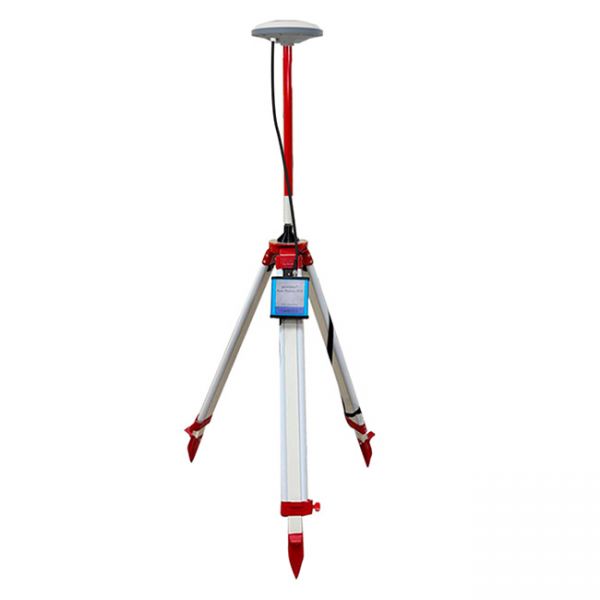
Multi-frequency GNSS RTK base station L1, L2, L5.
Professional GNSS RTK base station based on a multi-frequency board, has 965 channels and processes signals from GPS, GLONASS, GALILEO, BEIDOU satellite systems.


