
GNSS receiver Walker RTK. Real use case for landscape surveying with 3D model creation in Digitals software
17.11.2022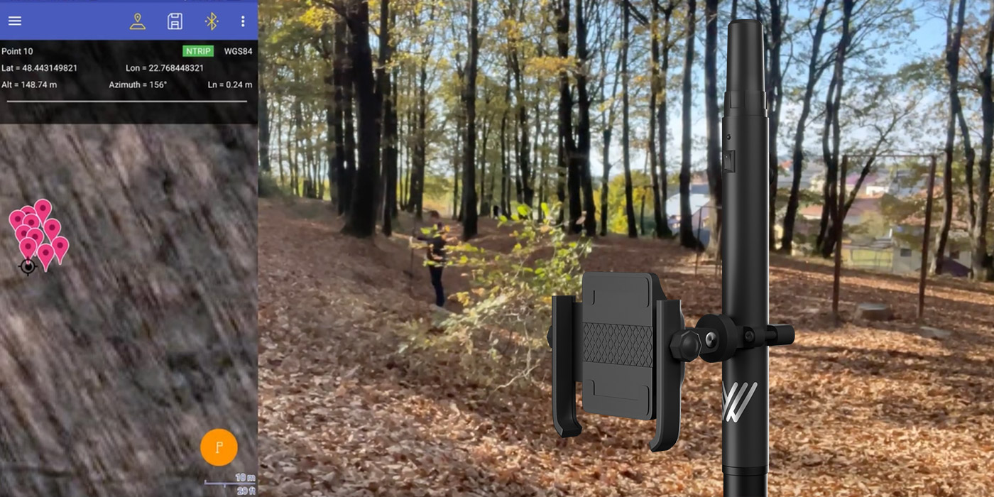
Designing of landscape design, drainage systems, construction, laying of pipelines, arrangement of trenches and channels can not do without the stage of obtaining the parameters of the terrain by high-altitude and planned survey of a given land plot. The specific features of these works are that they are all carried out on site and the mobility factor in the use of measuring instruments is a significant advantage when choosing them.
The Walker RTK GNSS receiver is just such a solution that 100% satisfies the needs for high-precision plan-altitude terrain surveying and is extremely lightweight and mobile.
In this use case, our task was to show all the advantages that landscapers, geodesists, service workers, designers will get when using the Walker RTK GNSS receiver based on a real complex terrain with elevation changes and irregular geometry.
Initial information and equipment
The terrain is in a forest zone with significant elevation differences.
The equipment that was used:
- GNSS receiver Walker RTK
- Smartphone with Android OS version 9.0 and higher
- Geometer Scout mobile application installed on a smartphone
- Foldable pole
- Digitals software for processing results and creating 3D terrain model
*During the work, the Walker RTK GNSS receiver was connected to network corrections from the ZakPos operator.
Performing measurements
The first step to create a 3D terrain model is to obtain a point cloud with their 3D coordinates. To do this, we used a Walker RTK GNSS receiver bundled with our proprietary application
Geometer Scout, which perfectly copes with this function. The coordinates of each point are saved in a project created in Geometer Scout and the point markers are immediately displayed on a Google map in terrain mode, or another that you set in the settings.
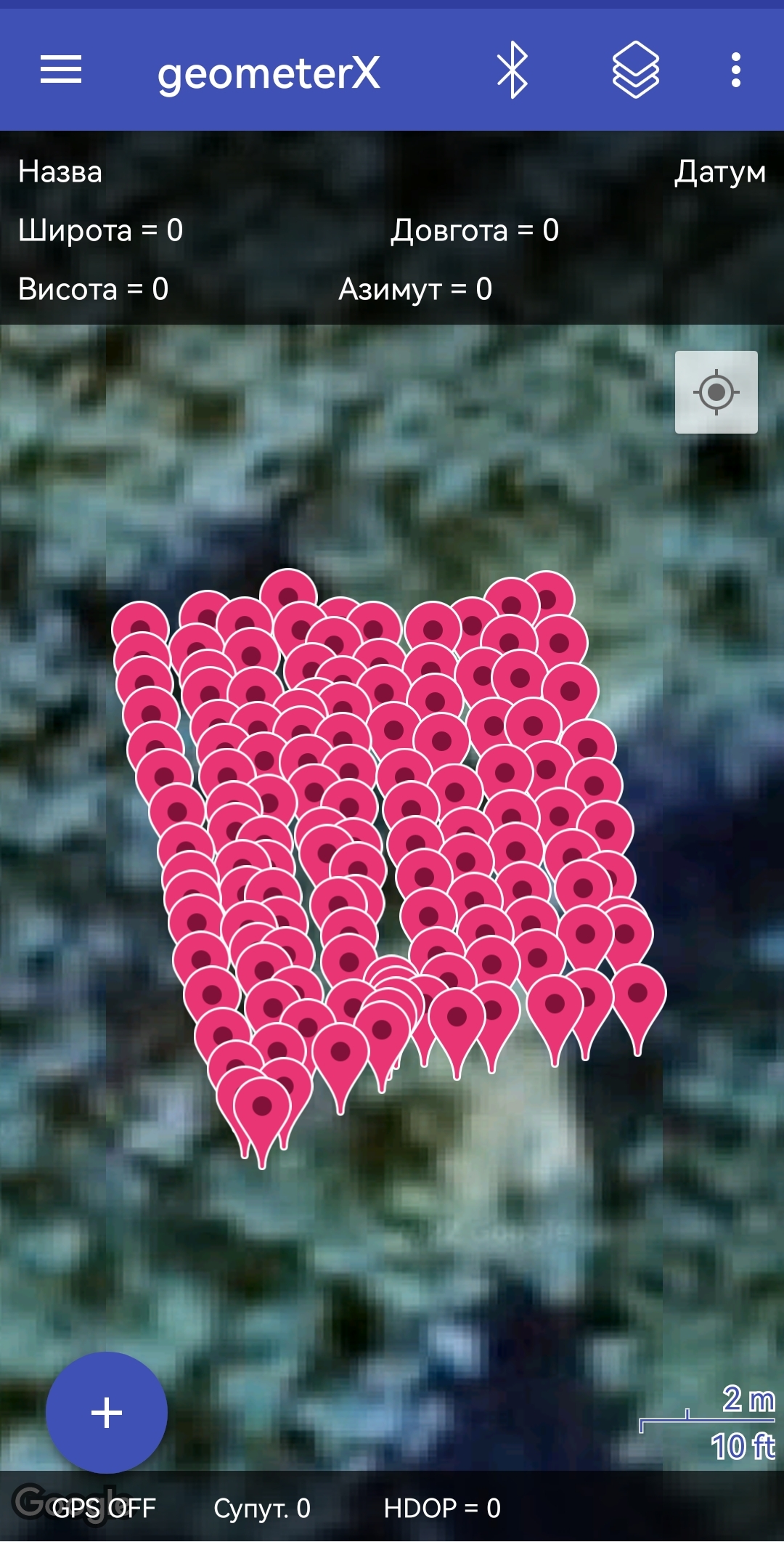
Creating a point cloud is a key factor that affects the detail of the final result in the form of a 3D model. By creating a larger and denser grid of points, the more detailed and accurate the model will be.
In practical sense, this means that the heavier and less mobile the GNSS receiver is, the more time-consuming this task becomes. And Walker RTK with its 250 grams of weight is the undisputed leader in the ease of performing the task of 3D point surveying.
The second factor that affects the speed of this operation is the stability of the fixed RTK signal solution. And despite the fact that the survey was carried out in a forest area, the fixed solution was stable throughout the entire measurement time.
Results processing
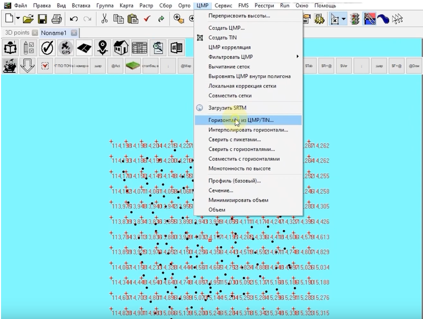
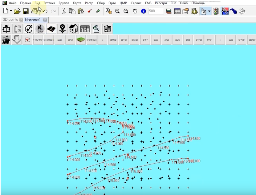
Having completed the first stage, and having received a point cloud of the selected terrain, our task was to transfer the results to a specialized software Digitals, which allows you to create a 3D terrain model from the point cloud.
The transfer is done in just 2 clicks and takes no more than a minute.
The first is to download the project file from the Geometer Scout application in KML format using the Export function built into the application.
The second is to import the KML file into Digitals and get a point cloud with its parameters.
The result
After performing the appropriate actions in the Digitals software, we received a detailed 3D terrain model, which can be used by designers of landscape, infrastructure elements and other objects for further work.
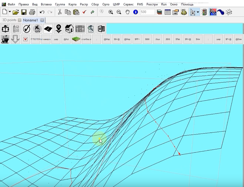
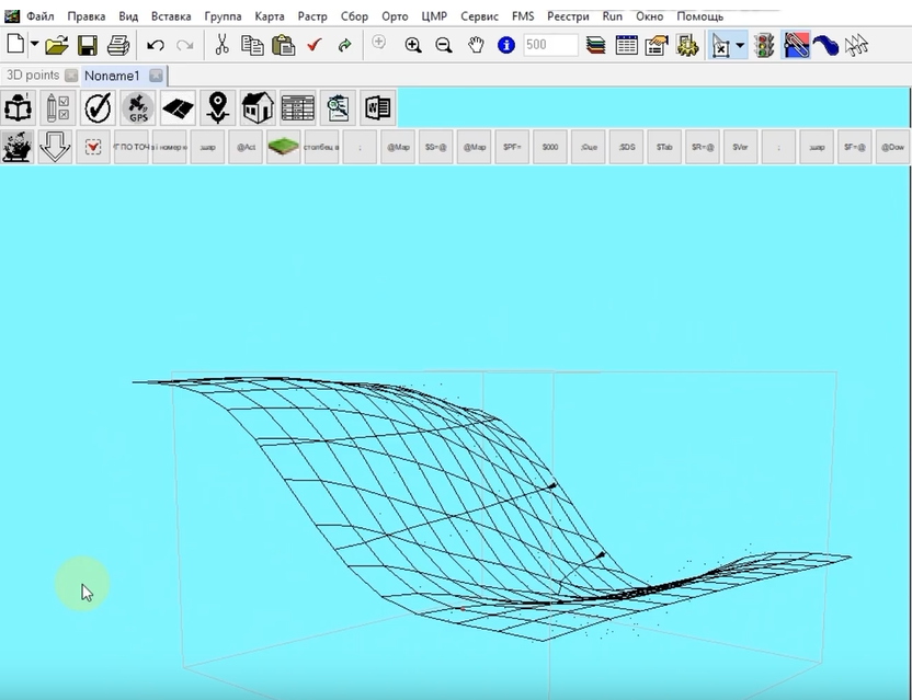
We chose the Digitals software because it has built-in functionality that allows you to perform the task of building a 3D terrain model based on the point cloud uploaded to it in just 2-3 clicks. Other programs and applications with similar functionality are also suitable for this task.
Conclusions
What conclusions can be drawn from this example of working with the GNSS receiver Walker RTK and the Geometer Scout application.
Firstly, it is a lightweight and convenient device that significantly increases productivity and reduces the labor intensity of terrain surveying in comparison with professional kits.
Secondly, the use of the Geometer Scout application in the kit allows you to perform many manipulations with the obtained data and seamlessly export them to other projects.
Thirdly, despite its compact size, Walker RTK maintains a stable fixed RTK solution even when working in terrain with natural or artificial obstacles.
Video on this use case

The Walker RTK with geometer mobile app is a compact and easy-to-use ideal tool for 3D surveying manholes, sidewalks, curbs, steps, landscaping, mapping trenches, and underground utilities such as electricity, gas, water, and sewer lines.

Walker RTK with professional surveying mobile application SurPAD is the ideal kit for surveying, as well as for 3D surveying manholes, sidewalks, curbs, steps, landscaping, mapping trenches, and underground utilities such as electricity, gas, water, and sewer lines

Full set of equipment Walker RTK with professional surveying mobile application SurPAD 4.2 is the ideal kit for surveying, as well as for 3D surveying manholes, sidewalks, curbs, steps, landscaping, mapping trenches, and underground utilities such as electricity, gas, water, and sewer lines