
Utility mapping is the process of identifying and mapping underground assets such as water and gas lines, electrical cables, and fiber-optic networks. These assets play a crucial role in our daily lives and the accurate mapping of them is essential for infrastructure management and planning.
Traditionally, utility mapping was done using techniques such as manual digging and vacuum excavation, which can be time-consuming, costly, and dangerous. However, with the advancement of technology, a new method has emerged that has revolutionized the utility mapping industry: GNSS Real-Time Kinematic (RTK).
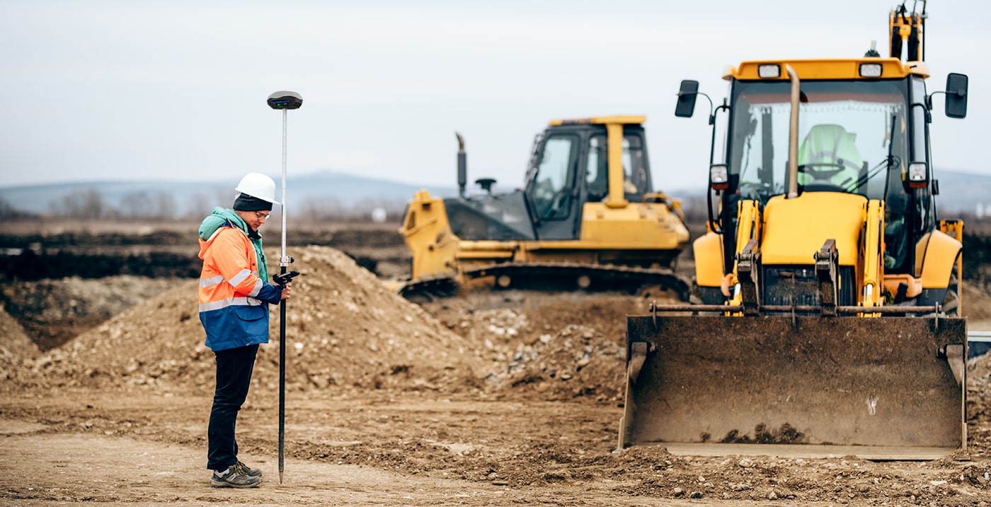
GNSS RTK is a positioning method that uses real-time corrections to improve the accuracy of GNSS (Global Navigation Satellite System) data. By using RTK, surveyors and mapping professionals can achieve sub-centimeter accuracy, which is a significant improvement over traditional GNSS methods. Next, we will explore the various benefits of using GNSS RTK for utility mapping projects.
How GNSS RTK improves accuracy of Utility Mapping
One of the most significant benefits of using GNSS RTK for utility mapping is the increased accuracy it provides. RTK improves the accuracy of utility mapping by using real-time corrections to GNSS data, which allows surveyors and mapping professionals to achieve sub-centimeter accuracy.
This increased accuracy is crucial for avoiding costly and time-consuming mistakes, such as mistakenly cutting into a gas line or digging in the wrong location. For example, a utility company in Texas used GNSS RTK technology to map their underground assets and were able to reduce their excavation costs by 30% due to the increased accuracy of the mapping.
Another example is a city in Canada that used handheld GNSS RTK device to map their underground infrastructure. The increased accuracy provided by RTK allowed them to identify and map assets that were previously unknown, which helped them to make better-informed decisions about infrastructure management and planning.
The increased accuracy provided by GNSS RTK not only helps to avoid mistakes but also leads to cost savings. By reducing the number of errors made on a project, companies can save money on excavation and repair costs. The increased accuracy also allows for better planning and decision making which can ultimately lead to cost savings for both the company and the customers.
How GNSS RTK improves efficiency and saves costs of Utility Mapping
GNSS RTK technology is a game-changer for the utility mapping industry. It provides increased accuracy, improved efficiency, improved safety, and cost savings. The benefits of using GNSS RTK for utility mapping projects are numerous, making it a valuable tool for infrastructure management and planning.
The increased accuracy provided by GNSS RTK is crucial for avoiding costly and time-consuming mistakes and leads to cost savings. The increased efficiency provided by GNSS RTK allows surveyors and mapping professionals to complete projects faster and with less equipment, leading to significant cost savings. The improved work safety provided by GNSS RTK helps to reduce the risk of accidents and injuries on the job, and the cost savings provided by GNSS RTK can lead to significant financial benefits for both the company and the customers.
As the world becomes more dependent on accurate and efficient mapping of underground assets, it's important for industries to adopt this technology. With the continued advancements in GNSS RTK technology, the future of utility mapping is looking promising. We call upon industries and organizations to adopt this technology and take advantage of the benefits it provides for infrastructure management and planning.
One of the providers of GNSS RTK devices for utility mapping is Geometer International LLC, a reliable and innovative manufacturer of handheld GNSS RTK receivers, Android App for Utility GPS Mapping, and mapping GIS platform. Their products are designed to make the process of mapping more accurate, efficient, and safe. We encourage you to explore the possibilities of Geometer International LLC's GNSS RTK technology for your utility mapping projects and see the positive impact it can have on your organization. With the growing need for accurate and efficient mapping of underground assets, GNSS RTK technology is poised to play an even more critical role in the utility mapping industry in the future.

The Walker RTK with geometer mobile app is a compact and easy-to-use ideal tool for 3D surveying manholes, sidewalks, curbs, steps, landscaping, mapping trenches, and underground utilities such as electricity, gas, water, and sewer lines.

Multi-frequency GNSS GM PRO L KIT. The receiver has 965 channels, receives a signal from satellite systems GPS, GLONASS, GALILEO, BEIDOU, QZSS, IRNSS. Receiver works with L1, L2, L5 bands. The receiver is designed for performing of surveying works, such as: stakeout, determination of the exact boundaries of sites, land surveying, field area measurement, stake out points, stake out lines, GIS survey, stakeout roads, cross-section measurement, slope staking, power line survey, height control and other functions. The kit comes in a sealed shockproof box.

Special kit for positioning with centimeter RTK accuracy and obtaining high-precision coordinates. The set consists of a dual-frequency GNSS receiver GM PRO model U, rugged smartphone with geodetic software installed.