
GNSS RTK receiver GEORA IMU


GNSS RTK receiver GEORA IMU
- Online Payment
- Payment by Invoice
- Bank Transfer
- Air Mail Delivery
- Delivery via DPD
- Delivery via DHL
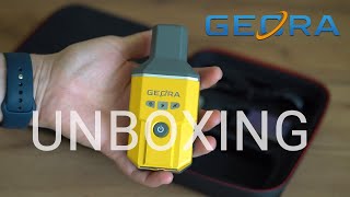
Compact GNSS RTK receiver GEORA with IMU and SurPad 4.2 program for Android.
The GNSS RTK receiver GEORA is a very compact and lightweight geodetic GNSS device, as it weighs only 220 grams. It features a hermetically sealed and impact-resistant body, and can withstand falls from a height of 1.6 meters. However, despite its small size, it is equipped with a high-performance board with 1408 channels. The GNSS RTK receiver GEORA processes signals from all satellite systems across all frequency bands. The GEORA receiver works well even in challenging conditions. Additionally, this mini RTK receiver is equipped with a rapid initialization IMU module, which is calibration-free and resistant to magnetic interference. All users can use this technology for shooting or staking out points at angles up to 90°. Thanks to its compact design, the GNSS RTK receiver GEORA is one of the best options for various measurement scenarios, such as geodetic surveying, agricultural measurements, GIS, pipeline measurements, and so on.
The receiver has 1408 communication channels with satellites and works with all satellite systems and frequencies:
- GPS: L1C/A, L1C, L2C, L2P(Y), L5
- GLONASS: G1, G2, G3
- Galileo: E1, E5a, E5b, E6
- BDS: B1I, B2I, B3I, B1C, B2a, B2b
- QZSS: L1C/A, L1C, L2C, L5
- NavIC: L5
- SBAS: WAAS, EGNOS, MSAS, GAGAN, SDCM
The main advantages of the GNSS RTK receiver GEORA:
- Multifrequency Support: It supports all existing satellite systems (GPS/GLONASS/Galileo/BDS/QZSS) on frequencies L1, L2, L5, which means it can accurately determine locations almost anywhere in the world.
- High Precision: The receiver is equipped with 1408 channels, ensuring precise positioning at the 1 cm level through the use of GNSS corrections from a network or individual base station. Thanks to the built-in IMU, the receiver can be used without a bubble level.
- Versatile Application: Can operate in PPK mode (post-processed kinematic). Features Bluetooth and 8 GB of built-in memory. An ideal receiver for geodetic works, road construction, power line surveys, land leveling control, CAD applications, and much more.
- Portable and Durable: Designed to operate in tough conditions. The GEORA has excellent heat dissipation, weighs only 220 grams, and is resistant to water and dust (IP67). It can be carried in a shirt pocket or on the wrist with a metal clip.
- Easy to Use: Connects to any Android and iOS devices to provide professional location data. Operates for up to 15 hours on a single charge.
Positioning accuracy with tilt at a fixed RTK solution:
Package Includes:
- Multifrequency GNSS Receiver GEORA;
- Permanent SurPad 4.2 License for Android;
- Charging adapter 220 V (US+EU);
- Charging Cable USB Type-C;
- Pole Adapter;
-
Clip for attaching the receiver;
-
Hand strap;
- Carrying Soft Bag.
The GNSS RTK receiver GEORA is a versatile and powerful GNSS receiver, well-suited for a wide range of applications, including:
- Surveying
- GIS
- Pipeline Measurements
- Construction
- Agriculture
- Landscape Design
- Digitalization of Engineering Networks
- Mining Industry
- Forestry
RTK Method
The essence of the GNSS RTK method involves simultaneously receiving satellite signals by a mobile rover at a point, and by a base station at a known static point. The base station records the difference between calculated and actual data and transmits RTK corrections to the rover. For the GEORA receiver, flexible adjustment of corrections from any available network broadcasting corrections via the RTCM protocol is provided. GeoMeter International LLC offers an effective solution - connecting GNSS RTK receivers to the RTK signal from the network of base stations. You can subscribe to RTK (receiving RTK corrections on the receiver) for different periods: a month, three months, six months, or a year. The multifrequency GNSS receiver GEORA allows for geodetic measurements with centimeter accuracy in real-time.
NMEA Protocol Support
The GNSS RTK receiver uses standard NMEA messages, ensuring high compatibility with all types of software supporting geolocation functions. This ensures precise and reliable coordinate determination.
Increasing Productivity
Purchasing the multifrequency GNSS RTK GEORA is sensible for significantly increasing your work productivity: with satellite equipment, you will be able to perform many more measurements on your own than you could in the same time with a partner using optical equipment.
Useful links
- Product page GEORA.
- SurPad DEMO version here.
- Download User Guide for SurPAD.
-
Dimensions (mm):135 * 42 * 64
-
Weight (kg):0.22
-
Manufacturer country:China
-
Accuracy:8 mm
-
Brand:geometer
-
Number of channels:1408
-
Positioning horizontal accuracy:8 mm + 1 ppm
-
Positioning vertical accuracy:15 mm + 1 ppm
-
Frequency:GPS: L1C/A, L2P(Y), L2C, L5 GLONASS: L1, L2 GALILEO: E1, E5a, E5b, E6 BDS: B1I, B2I, B3I, B1C, B2a, B2b1 QZSS: L1, L2, L5t
-
Range of working temperatures:-20 °C to + 60 °C
-
Bluetooth:4.2
-
Cold start:< 30 sec
-
Hot start:< 3 sec
-
Integrated memory:8 Gb
-
Power supply :Battery, 5V, 2A
-
Ingress Protection:IP67
-
Battery life:up to 15 hours
-
Tilt Compensation IMU:Yes
-
Warranty:1 year
-
Laser:No

A telescopic aluminum survey pole TS180 is designed for comfortable surveying. The four-section construction delivers reliable stability with the help of solid flip locks.

Universal aluminum holder designed to mount a smartphone for use on a geodetic pole or tripod.

Agricultural mobile application geometer SCOUT for Android smartphone or tablet. A low-cost solution that will allow you to carry out area measurement of any shape, measure distances, create electronic maps, staking-out, land surveying, cutting out unproductive areas (holes) and many other operations.