

In the geometer program, all measurements are displayed on Google maps and one touch turns into 3D view. In addition to standard maps, the set includes topographic, satellite, Open Street Map, and cadastral map.
Different modes of operation and field conditions require a certain type of map.
The distance to any point can be obtained, for example, at the corners of the cadastral area. The program shows the coordinates of the location, both during measurement and when drawing points. On any type of map, you will be shown your movement on the field map.
Depending on the operating modes, field conditions and preferences, the user chooses which layer of maps to work with on the ground.
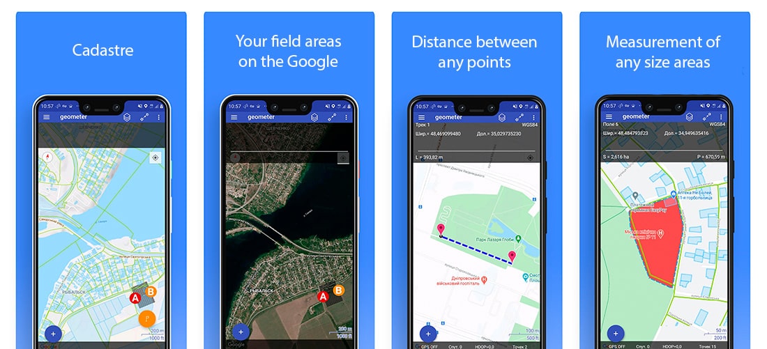
Map layers available:
- Standard map;
- Google Maps;
- Satellite veiw;
- Topographic map;
- Cadastre;
- Open Street Map;
- 3D map view;
- Grid view | No map.
Depending on the receiver of the Geometer field measurement kits, you will be able to reach a point with an accuracy of 1.5 meters to 1 cm. Also, we have an interesting all-in-one controller running Android OS with RTK and PPP accuracy — Geometer Y55G.
Choose the receiver that suits your needs.
Our technical specialists will consult you in more detail:
- + 38-050-594-14-68 (Viber, WhatsApp, Telegram)
- [email protected] ✉

The Y55G field controller is a modern geodetic controller with an integrated GNSS RTK receiver. It features a multi-frequency 1408-channel board supporting L1, L2, and L5 bands. The device supports all major satellite systems: GPS, GLONASS, BeiDou, Galileo, QZSS, and IRNSS, ensuring stable positioning even in challenging environments.

The single-frequency GNSS receiver "GM PRO S" of improved accuracy on a free satellite signal. A new series of receivers in a compact GM PRO mini body. The receiver has 335 channels for communication with satellites. Works with all satellite systems: GPS, GLONASS, GALILEO, BEIDOU, QZSS and can work in any country in the world. It can be used in geodesy, agriculture, forestry and other industries where high accuracy is important.

The Walker 2 receiver is an exceptionally lightweight and compact GNSS RTK device, weighing only 220 grams, designed for convenient use in any field conditions. Its sealed and shock-resistant housing withstands drops from heights up to 1.6 meters, ensuring reliability on construction sites, in agriculture, and in challenging terrain.