
Works to measure the area of a field or any land area is a common operation not only among farmers but also in other industries working with land resources. As long as such work is one-time or its scale is small and does not require centimeter accuracy, the requirements for the selection of GPS devices for measuring the area are minimal. In this case, ordinary smartphones with free apps, travel navigators, etc. are used. These household gadgets provide mostly general information about the approximate area, the shape of the plot, and perimeter, and allow a limited number of points.
If the work to measure the area of the land is a professional need, the option with home GPS devices is not suitable and has to refer to the GNSS/RTK kits measuring the area of land at the professional level.
Nevertheless, some users, already using good quality tourist navigators, are trying to use them for professional purposes.
Let's clarify the fundamental differences between professional and touring GNSS devices for measuring areas.
The difference between professional and touring GNSS area meters
Let's compare these 2 classes of measuring instruments based on the pros and cons of each of them.
Advantages of tourist instruments for measuring area:
- compactness;
- a higher level of protection against shocks falls and moisture;
- mainly lower price (depending on the manufacturer).
Disadvantages of tourist area measuring devices:
- small display size;
- lower accuracy;
- a limited number of storage points;
- a limited number of locations for storage;
- lack of specialized map layers and the ability to stack them;
- lack of integration with additional services such as Google Maps.
Advantages of professional GNSS area measurement devices:
- improved accuracy of area measurements up to 0.5%;
- support of many satellite systems;
- screen size is not limited by one device;
- considerable autonomy in operation;
- an unlimited number of storage points;
- unlimited number of storage areas;
- integration with Google Maps and other map services;
- ability to use additional maps (layers) and integration with API of other services.
Disadvantages of professional GNSS instruments for measuring area:
- large size and weight;
- somewhat high price (not for all models).
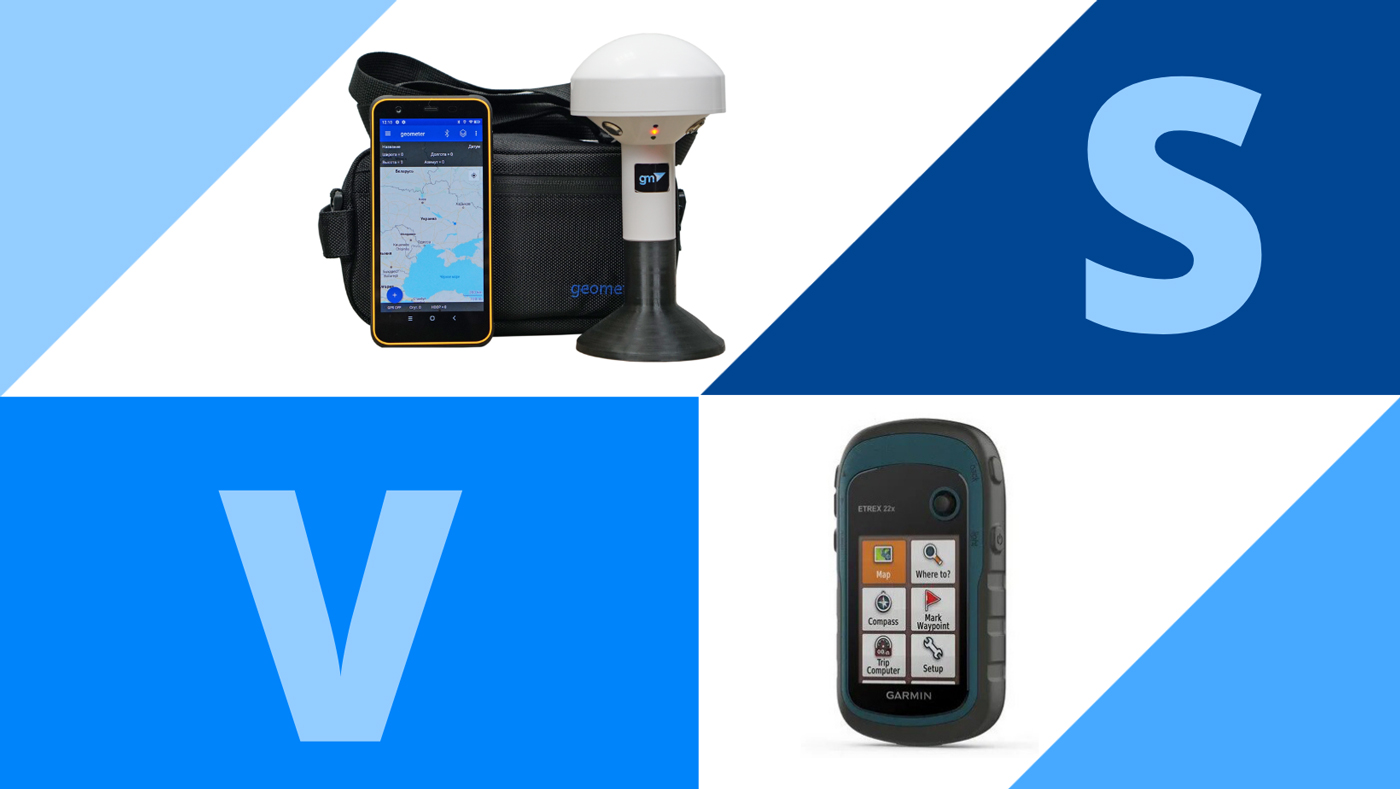
For example, here is a comparison table of the most popular models of Garmin travel navigators and GNSS device Geometer Scout GM Spike.
|
Parameters/Model |
Geometer Scout GM Spike |
Garmin Montana 700i |
Garmin GPSMap 65s |
Garmin eTrex 22x |
|
Satellite systems support |
GPS, Galileo, Beidou, Glonass |
GPS, Galileo |
GPS, Galileo, Glonass |
GPS, Glonass |
|
The number of saved points on the area |
is not limited to |
250 |
200 |
200 |
|
Total number of saved points |
is not limited to |
10000 |
10000 |
10000 |
|
The number of saved areas |
is not limited to |
250 |
200 |
200 |
|
Average price, $ |
560.00 |
700.00 |
400.00 |
200.00 |
A comparison of the basic characteristics shows that the main difference between professional devices is the ability to scale and accumulate data and a large variety of satellite system support. At the same time, the price of some models of tourist Garmin is even higher and on this parameter does not give an advantage over the professional.
The analysis of the Garmin models line shows that only a limited number of models have the support of 3 or more satellite systems, the rest are limited to a maximum of 2 depending on the region of sales. Professional devices can be used all over the world without being limited by location.

Agricultural mobile application geometer SCOUT for Android smartphone or tablet. A low-cost solution that will allow you to carry out area measurement of any shape, measure distances, create electronic maps, staking-out, land surveying, cutting out unproductive areas (holes) and many other operations.

The Walker RTK with geometer mobile app is a compact and easy-to-use ideal tool for 3D surveying manholes, sidewalks, curbs, steps, landscaping, mapping trenches, and underground utilities such as electricity, gas, water, and sewer lines.