
The task of measuring the area of any land plot has now actually been simplified to 2 steps.
1. To find and install a special mobile application on Android or IOS.
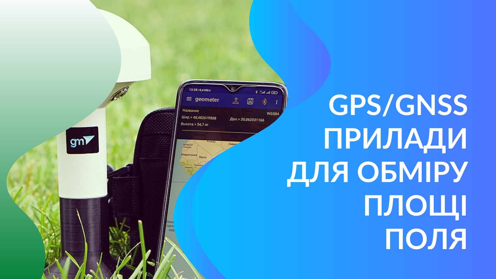
2. To go around the area along the perimeter with the smartphone and GPS/GNSS receiver and get the area and contours of the area in the installed program.
At first glance, everything is simple, there is a contour, the program also calculated the area, and if the main task was to take a walk in the fresh air, we can say that the mission was 100% completed. And if you need to get the real area and a smooth contour of the land, then this method of measurement will not work for you at all.
What is the difference between GPS equipment for measuring the area of fields?
All GPS/GNSS devices for measuring land area can be divided into the following groups:
- Smartphone with internal gps module
- Sports and consumer gps devices
- Smartphone with external GPS/GNSS receiver, basic accuracy receiver
- Smartphone with external GPS/GNSS receiver, enhanced accuracy receiver
- Smartphone with external RTK receiver
All equipment, with the exception of the last one, works with a free signal that they receive from one or another satellite system. To obtain centimeter accuracy, a network of base ground stations is used, which transmit corrections in real time and significantly improve positioning accuracy.
Let us analyze what error in measuring the area gives the listed equipment.
A smartphone with an internal GPS module is one of the most inaccurate options for measuring field area. The error when using it can be more than 10%.
Sports and consumer gps devices are not much better than the first option, they also have a small gps antenna and cannot provide proper measurement accuracy.
A smartphone with an external GPS/GNSS receiver of a basic level of accuracy is already a device that radically differs in accuracy from the first and second options. Let's start with the fact that, unlike the previous options, the antenna and receiver are a separate device that connects to a smartphone via Bluetooth. The physical size of the antenna in it is 2-3 times larger than in a regular smartphone GPS module. Such a solution allows not only to receive a stronger signal, but also to "see" more satellites at the same time. Another feature is that such an antenna, thanks to a special receiver module, can “catch” a signal not only from one satellite network, but from several at once, thereby improving accuracy and this is no longer a GPS, but a GNSS receiver.
The error in measuring the area with such equipment is about 0.5-1%, which is many times better than the previous options. As for the performance of only one task - measuring the area of the field, then such a system will be quite enough for 99% of cases. If you need to get a multifunctional system, where, in addition to the task of measuring the area of fields, stake-out or determining the boundaries of a land plot will be added, then the level of accuracy of such a device will not be enough.
Smartphone with external GPS/GNSS receiver, enhanced accuracy receiver. Such equipment will still work with a free satellite signal, but due to the increased size of the antenna and special smoothing filters, only the satellites with the best signal are “selected”, the accuracy of linear measurements will be higher than in the previous version. For example, when staking-out or surveying, it will give an accuracy of 20-30 cm, while at the same time, as in the base one, only 50-70 cm. Another significant difference will be the quality of the measurement contour. In an instrument with a GNSS antenna and an anti-aliasing filter, it will be smoother in most cases due to the higher point density, which depends on the frequency of the receiver. For basic it is 1 Hz, for improved 5-10 Hz. The dot density can also be controlled by the settings of the software that the receiver works with, so this number may vary from vendor to vendor.
Devices with this configuration can be considered a professional level for agronomists and the land control service of an enterprise involved in the digitization of fields. But still, such a device will not be enough for professionals - land surveyors.
Smartphone with external RTK receiver - a professional measuring device that will help to draw out the boundaries of the land plot, mark the roadway or construction site with an accuracy of 1-2 cm. Measurement accuracy is achieved thanks to a special network of base stations that simultaneously receive a signal from satellites and connect to a rover (usually a pole with an RTK receiver), receiving the difference in these measurements, corrections are sent to the RTK receiver to compensate for those location errors, which gives a direct connection to the satellites.
What area measurement equipment is available on the market?
Even 4-5 years ago, the absolute leader in sales of field area measuring devices were compact devices in the form factor of a tablet running on Windows Mobile OS with specialized software. These are simple and compact devices with one main function - field area measurement. They can still be found in sales in companies that have not been able to adapt to new technologies with the advent of the powerful and flexible Android operating system.
Modern field area measuring devices are equipped with rugged smartphones with Android OS and an external GPS/GNSS receiver.
Geometer offers 3 types of receivers, Spike - for basic accuracy, Smart - for enhanced accuracy and Smart M or GM RTK - for surveying.
Other companies usually specialize in devices of basic accuracy or have occupied a specialized niche for the sale of high-quality and very expensive equipment from world-famous brands (Trimble, Leica, Topcon).