
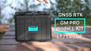
Multi-frequency GNSS RTK GM PRO L KIT


Multi-frequency GNSS RTK GM PRO L KIT
- Online Payment
- Payment by Invoice
- Bank Transfer
- Air Mail Delivery
- Delivery via DPD
- Delivery via DHL
The Multi-frequency GNSS GM PRO L KIT works in frequency ranges L1, L2, L5, has 965 channels for performing of surveying works, such as: stakeout, determining clear boundaries of areas, land surveying, field area measurement, stake out points, stake out lines, GIS survey, stakeout roads, cross-section measurement, slope staking, power line survey, height control and other functions.
GM PRO mini Series
A special set of GNSS positioning equipment with centimeter accuracy. The kit includes a modern smartphone, which is used as a controller with geodetic software SurPad or geometer SCOUT, and a multi-frequency GNSS receiver GM PRO L. The GM PRO L receiver has a light weight of only 0.59 kg, and the complete set with a carrying case has 3.3 kg. The kit comes in a sealed shockproof box.
The receiver has 965 channels for communication with satellites and works with all satellite systems and frequencies:
- GPS: L1 C/A, L2C, L2P, L5
- GLONASS: L1 C/A, L1P, L2 C/A, L2P
- Galileo: E1, E5a, E5b
- BeiDou: B1, B2, B3
- BeiDou Global Signal: B1C, B2a, B2b
- QZSS, IRNSS
- L- Band
- SBAS: WAAS, EGNOS, MSAS, GAGAN, SDCM
Equipment:
- Multi-frequency GNSS receiver GM PRO L;
- Smartphone, RAM: 8 GB, internal memory: 128 GB;
- SurPad or geometer software;
- Carrying case;
- Pole mount for smartphone;
- Charging cable;
- Foldable pole TS180 or geodetic pole.
Industries of use for the multi-frequency GNSS GM PRO L KIT:
- Surveying
- Cadastral work
- Construction support
- Machine control systems in construction
- Forestry
- Landscaping
- Utilities
- Precision farming
The main advantages of the multi-frequency GNSS GM PRO L KIT:
- Measurement accuracy 8 mm horizontal and 15 mm vertical;
- Fast initialization due to the presence of three frequencies;
- Flexible configuration for any GNSS RTK network;
- The receiver has 965 channels, receives a signal from satellite systems GPS, GLONASS, GALILEO, BEIDOU, QZSS, IRNSS;
- Obtaining corrections 1024-1027 for local geodetic coordinates;
- Staking out using the GM PRO L is much easier than using a total station: the measurement can be done alone;
- GNSS receiver GM PRO L operates from 5V, which allows it to be powered from any external 5V battery or geometer Power Station;
- The perfect combination of reliability and value.
RTK Method
The essence of the GNSS RTK method is to receive a satellite signal simultaneously by a mobile rover at a point and by a base station at a known static point. The base captures the difference between the computed and actual data and sends the RTK correction to the rover. The GM PRO L KIT provides flexible adjustment of corrections from any available network broadcasting corrections via the RTCM protocol. Geometer company offers an effective solution - connecting GNSS RTK receivers to an RTK signal from a network of base stations. You can subscribe to RTK (receiving RTK corrections to the receiver) for a different period: a month, three months, half a year or a year. Multi-frequency GNSS receiver GM PRO L allows real-time geodetic measurements.
Support for NMEA Protocol
The GNSS RTK receiver uses standard NMEA messages, ensuring high compatibility with all types of software that support geolocation functions. This provides accurate and reliable coordinate determination.
Increasing Productivity
It is advisable to buy a multi-frequency GNSS RTK kit to significantly increase your productivity: with the help of satellite equipment you will be able to perform much more measurements alone than you would at the same time with a partner using optical equipment.
Professional Assistant of Surveyor
Measured object files can be used in any application thanks to built-in file export capabilities. You can export data to the following formats: CSV, TXT, KML (for Google Earth). Also, using the Agroprofile website, you can display a field map on top of Google Maps maps in separate layers, get complete information about each field.
Useful links
- Product page: SurPad App.
- Product page: geometer SCOUT software.


-
Dimensions (mm):339 x 295 x 152 mm
-
Weight (kg):3.3 kg
-
Manufacturer country:Ukraine
-
Accuracy:8 mm
-
Brand:geometer
-
Number of channels:965
-
Positioning horizontal accuracy:0.008 m + 1 ppm
-
Positioning vertical accuracy:0.015 m + 1 ppm
-
Sattelite systems:GPS: L1 C/A, L2C, L2P, L5; GLONASS: L1 C/A, L1P, L2 C/A, L2P; Galileo: E1, E5a, E5b, AltBOC; BeiDou: B1, B2, B3; BeiDou Global Signal: B1C, B2a; QZSS: L1C, L2, L5, L1C/A; IRNSS1; SBAS: WAAS, EGNOS, MSAS, GAGAN
-
Frequency:1-20 Hz
-
Range of working temperatures:-40°C to + 85°C
-
Bluetooth:4.2
-
Cold start:40 sec
-
Warm start:15 sec
-
Hot start:1 sec
-
RAM:8 Gb
-
Integrated memory:128 Gb
-
Power supply :Battery
-
Communication standard support:2G/3G/4G
-
Ingress Protection:IP67
-
Battery life:up to 15 hours
-
Tilt Compensation IMU:No

Multi-frequency GNSS RTK base station L1, L2, L5.

Geometer Power Station is a lithium-ion battery in an aluminum body with a capacity of 3400 mAh. This is a useful accessory for GNSS receivers and GeoMeter devices, which will allow you to get extra charge in the field.

Real-time GNSS (RTK) network package for a year (12 months). Includes functions from a single base station - "nearest" and network solutions - Automax, I-Max, VRS.