Geodetic software application Survey Master
Geodetic software application Survey Master
- Online Payment
- Payment by Invoice
- Bank Transfer
- Air Mail Delivery
- Delivery via DPD
- Delivery via DHL
A geodetic software application designed for working with GNSS equipment on Android-based devices.
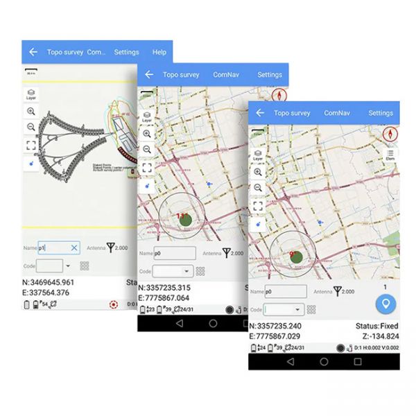
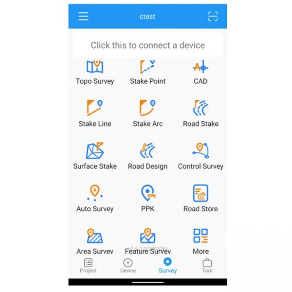
Survey Master is a powerful Android software that provides a full range of tools for professional geodesy and cartography. This app enables users to perform topographic surveys, automatic surveys, static measurements, and PPK mode operations, as well as edit and stake out points and lines. Survey Master supports importing and exporting geodetic data in TXT, CSV, SHP, and AutoCAD DXF formats, ensuring seamless data exchange across various platforms and devices.
Ease of Use
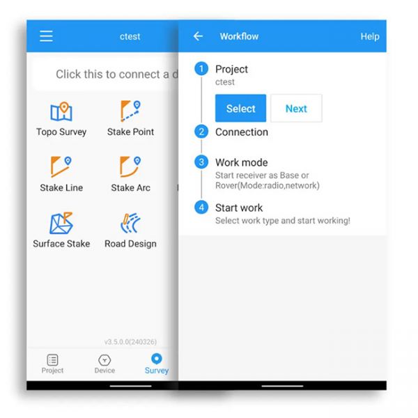
Survey Master’s interface is designed with user convenience in mind, offering an intuitive and user-friendly layout. A built-in assistant function helps newcomers easily navigate the entire surveying process by following step-by-step guidance. For professionals, the app offers a comprehensive set of features to handle a variety of geodetic tasks.
High Compatibility
Built on the Android platform, Survey Master is compatible with a wide range of Android devices, including smartphones and data collectors. The app supports the NMEA protocol, enabling connectivity with GNSS devices that output information in this format.
Extensive Functionality
Survey Master boasts a rich set of features for different operating modes, including RTK, PPK, and static modes. The app supports tasks such as road staking, surface staking, topographic surveying, and object surveying. Additionally, Survey Master features IMU tilt compensation up to 60°, enhancing measurement accuracy in challenging conditions. Its ability to import CAD files and use them directly for staking simplifies the workflow. The app also supports converting raw Binary files into the RINEX format for further processing.
Key Advantages of Survey Master:
- Compatibility with most Android devices
- Intuitive interface with an assistant function
- IMU tilt compensation up to 60°
- Support for all surveying modes: static, PPK, and RTK
- Advanced features like surface staking, topographic surveying, and more
- CAD file import for direct use in staking tasks
- Conversion of Binary files to RINEX format
Survey Master is a reliable tool for professional surveyors and engineers, ensuring efficiency and accuracy in daily operations.


