
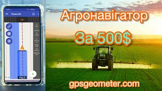
Agricultural Navigation System Geotrack Lite GNSS X2


Agricultural Navigation System Geotrack Lite GNSS X2
- Online Payment
- Payment by Invoice
- Bank Transfer
- Air Mail Delivery
- Delivery via DPD
- Delivery via DHL
The agricultural guidance system (tractor GPS/GNSS) Geotrack Lite with the new GNSS X2 receiver. An affordable agricultural navigation system with enhanced accuracy and quality components.
The Geotrack Lite GNSS X2 provides a basic level of accuracy that allows for effective management of machinery with wide-coverage implements during field operations such as spraying, fertilizing, and applying plant protection products. The GNSS X2 receiver improves the sensitivity and quality of the satellite signal.
The system provides information on the screen for managing machinery, records the movement trajectory in the form of a track, and accurately calculates the treated area. The Geotrack software ensures ease and simplicity of operation in the field, with all controls managed by a single touch on the screen. The intuitive menu does not require special training for the operator.
Synchronization of fields and tasks via Wi-Fi with the Agroprofile portal www.agroprofile.com significantly simplifies planning tasks and provides the ability to remotely control the execution of field operations.
The application of Geotrack software allows for precise management of agricultural machinery in conditions of poor visibility - during night-time, fog, or in conditions of heavy dust.
Pass-to-pass accuracy:
Supported operating systems and software:
Operating system:
Android
version 9.0 and above
Application:
Geotrack
Equipment:
- Tablet 8.7 inches
- Receiver GNSS X2
- Mobile application geotrack
- Protective Case for Tablet
- Professional Tablet Mount
- RAM Mount
- Magnetic holder for GNSS receiver
- 12V cigarette lighter adapter
Functionality:
- Accurate guidance from pass-to-pass
- Accurate area measurement
- Treatment of saved fields
- Determining the treated area
- Visualization of the treated area
- Displaying the movement speed
- Displaying azimuth
- Five guidance patterns
- Adjustment of width of equipment (to centimeters)
- Online technical support
- Saving a field map
- Automatic saving works
- Specifying Job Types (sowing, spraying, etc.)
- Online sync with Agroprofile
Operating modes:
- Area measurement
- Area measurement with offset
- Free guidance mode
- Straight A-B
- Curve A-B
- Perimeter - Straight A-B
- Perimeter - Curve A-B
What data is displayed while driving:
- Treated area
- Travelled length
- Speed of movement
- Number of satellites
- Satellite signal quality (HDOP)
- Visual guidance tips
- Calculation of working time
- Count overlapping
- Visualization of overlapping
- Ratio: work done / in process
Useful links
- Free farm management system Agroprofile
- Learn more about Agroprofile
Quality control of field works
The new geotrack software has many functions to determine the quality of work: displaying the treated area, visualization of overlapping in a darker color. The system automatically captures the quality of field processing in real time.
Fuel economy
Accurate parallel guidance between rows will allow not to return to the treated areas for their completion. Field processing will be more controlled and accurate.
Save time and money
The agricultural guidance system is able to work at any time of day or night, in any weather, in fog, dust and poor visibility.
Saving herbicides and seeds
The agronavigator will allow to control precisely equipment between passes that will allow to distribute accurately and economically herbicides, sowing materials and other resources during field works.
Full synchronization with the office
This navigation kit has a built-in WI-FI module. With the help of wireless data transmission agronavigator will be constantly in touch with the online account Agroprofile. The manager will be able to monitor the progress of work in real time. The whole eco-system from the GeoMeter company allows you to change the quality of preparation and execution of works for the better.
Online technical support
It is very important to receive technical support from the supplier at the right time. Developers from GeoMeter company has taken this into account in its new development: devices with geotrack software can be tested and maintained using remote access, a company specialist will be able to connect to your display without leaving the field. To use this feature, you need an Internet connection via Wi-Fi.


-
Dimensions (mm):154 x 63
-
Weight (kg):0.45 kg
-
Manufacturer country:Ukraine
-
Accuracy:20-30 cm
-
Brand:geometer
-
Sattelite systems:GPS, Galileo, Glonass, Beidou
-
Bluetooth:4.2
-
RAM:8 Gb
-
Integrated memory:128 Gb