
Geometer GNSS/RTK applications for the design of land drainage and irrigation systems
27.10.2022- GNSS/RTK kits for the design of regulating, enclosing and leading networks of a drainage and irrigation system
- GNSS/RTK kits for hydraulic engineering, road network and operational parts
- GNSS/RTK kits for establishing the division of land for drainage and delineation
- GNSS/RTK kits for designing circular irrigation systems
Designing a drainage system task for agricultural land is not simple and consists of several stages. First, you need to design the regulating, enclosing and leading network. Next, you need to decide on the location of the water receiver, the layout of the hydraulic structures, the road network and the maintenance part.
The ultimate goal of the drainage and irrigation system establishment is to obtain drained plots of land with defined boundaries, for which crop rotations with appropriate crops are planned.
Practically every stage of construction of a drainage and irrigation system includes works on measuring a land plot, determination of its borders, determining area, and more complicated geodetic works on laying pipelines, drainage channels, etc.
A good land drainage and irrigation system design requires appropriate tools and software to do it as efficiently and quickly as possible.
It is especially true in swampy areas and climates with a significant rainfall. For example, in Ukraine, these are the Polissya and the northern regions. In England, Scotland and Ireland, the reclamation of drainage and irrigation systems is an urgent issue for many farmers, and Geometer devices will be helpful for them.
Let's see how Geometer's GNSS and RTK devices help to create a drainage and irrigation system for land plots.
GNSS/RTK kits for the design of regulating, enclosing and leading networks of a drainage and irrigation system
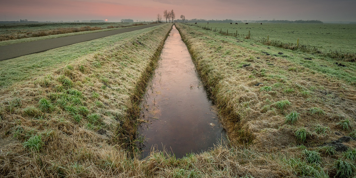
The regulating network stage consists of the construction of dewatering, drainage, and collectors of excess water to collect and drain it from the dewatered area. The fencing network requires the construction of pressure and catch channels and a dam to protect drained land from external moisture.
The leading network consists of main canals, moisture collectors and collectors. It connects all system elements with a water recipient (river, lake, pond, etc.).
Drainage and irrigation system network creation requires geodetic measurements with centimetre and sub-centimetre accuracy both in plan and height.
Kits with SurvX software for work in the local coordinate system will be the best option for devices for such work:
- GM RTK KIT Dual Frequency GNSS Kit
- Compact GNSS Walker RTK Receiver
- Multi-frequency GNSS kit GM SMART M KIT
They allow you to create a plan-elevation geodetic network for laying trenches, inspection wells and channels.
GNSS/RTK kits for hydraulic engineering, road network and operational parts
These stages involve the construction of structures to control the flow of water diverted or brought to the land. The creation of crossings, inspection wells and sluices helps to prevent network scouring and siltation.
Creation of a road network - roads, bridges, pipes, crossings - serves as the entry and exit points for transport and agricultural equipment to the drained land.
The operational part of the system - buildings, gauging stations, communication lines - helps in all components of the drainage network control and supervision.
The best option for kits, as with networking, for such works would be with SurvX software:
- GM RTK KIT Dual Frequency GNSS Kit
- Compact GNSS Walker RTK Receiver
- Multi-frequency GNSS kit GM SMART M KIT
Most of the work consists of the performance of the planned-altitude measurements, which will determine the exact location of roads, pipes, bridges and other parts of the system.
GNSS/RTK kits for establishing the division of land for drainage and delineation
The division of plots of land into individual crops to be grown on drained land is one of the main tasks in the construction of the drainage system.
It involves determining the shape and boundaries of each plot and its area to plan crop rotations and harvests based on these data.
Unlike previous works, they do not require sub-centimetre accuracy and can be carried out with more basic instruments with centimetre and decimetre accuracy.
Kits with the Geometer app are ideal for measuring areas:
- GM SMART KIT single frequency GNSS kit
- Geometer App with GM Spike receiver
- SCOUT GM Spike GPS Geometer Kit
- Compact GNSS Walker RTK receiver
These kits are designed primarily for the task:
- Measuring small areas
- Georeferencing
- Getting to a point
- Field mapping
- Subdividing fields
- Cutting out plots
- Field markings
- Area definition
- Distance estimation
GNSS/RTK kits for designing circular irrigation systems
The second part of irrigation and drainage design is the creation of irrigation systems. Only in this case can the dehumidification system be considered to be 100% maximally effective and work as a complete reclamation facility. In principle, all irrigation systems can be divided into fixed and mobile systems. However, whereas with portable systems, the design task is limited to the identification of sites for the temporary location of so-called sprinkler machines, the design of stationary systems requires the layout of areas in order to lay out the pipes for water application and effectively cover the additional wet area of the irrigation system.
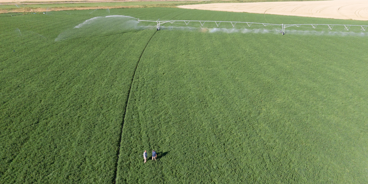
The most challenging task is the design of circular irrigation systems, which have proved their effectiveness over decades.
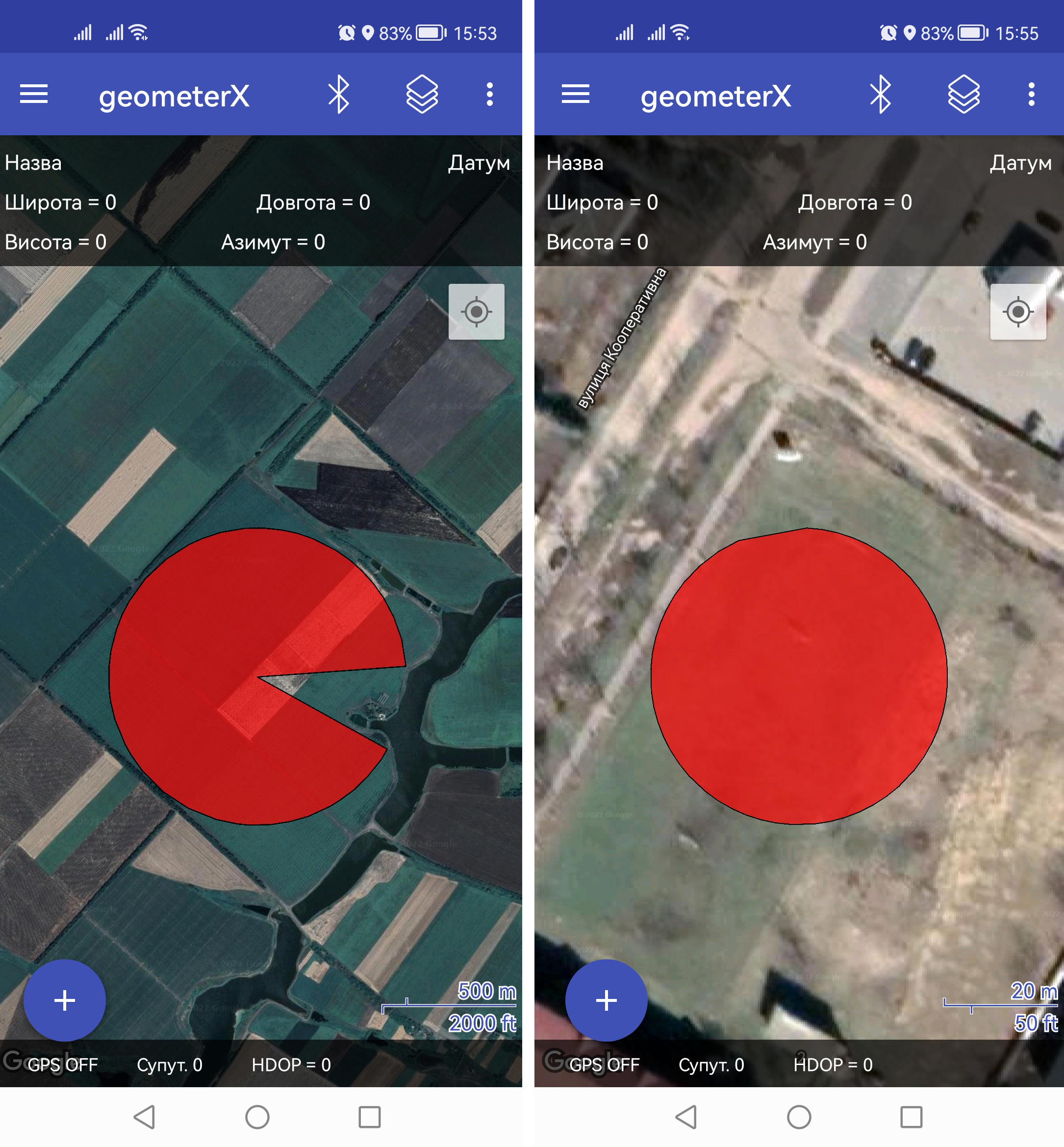
This task requires centimetre accurate work and the necessary functionality to mark a lap using GPS coordinates. The Geometer application already has this functionality to draw a circle based on a centre point, with the ability to save the coordinates and return to the point when a circular irrigation system needs re-installation in the area.
It is possible to create full circles and non-standard areas with a circle half or a missing sector of a given size.
For designing circular irrigation systems, kits with the Geometer app will be suitable:
- GM SMART KIT single frequency GNSS kit
- Compact Walker RTK GNSS Receiver
- Dual frequency GNSS kit GM RTK KIT
The complete Geometer instrument and software package fully covers the needs of planners and builders of drainage and irrigation systems in surveying and land surveying applications. Geometer kits simplify this work and allow farmers to design simple drainage and irrigation systems without involving external companies or expensive specialists.

Conjunto completo de equipos receptor GNSS compacto de doble frecuencia Walker RTK con aplicación geodésica SurPad 4.2 es una herramienta y fácil de usar ideal para la topografía 3D de pozos de registro, aceras, bordillos, escalones, paisajismo, cartografía de zanjas y servicios públicos subterráneos como líneas de electricidad, gas, agua y alcantarillado.

Conjunto de multifrecuencia equipos GNSS GM PRO L para geodesia. El receptor dispone de 965 canales y recibe señales de los sistemas de satélite GPS, GLONASS, GALILEO, BEIDOU, QZSS, IRNSS. Diseñado para realizar trabajos geodésicos, tales como: mediciones geodésicas, definición de límites claros de parcelas, levantamientos, medición de áreas de campo, ruptura de puntos, ruptura de líneas, levantamiento GIS, medición de diámetros, levantamiento de líneas de transmisión, control de altura y otras funciones.

Un conjunto especial de equipos RTK para posicionamiento de alta precisión y obtención de una precisión de coordenadas absoluta. El conjunto consta de un receptor GNSS de dos frecuencias GM PRO U, software para trabajos geodésicos (Android) y accesorios.